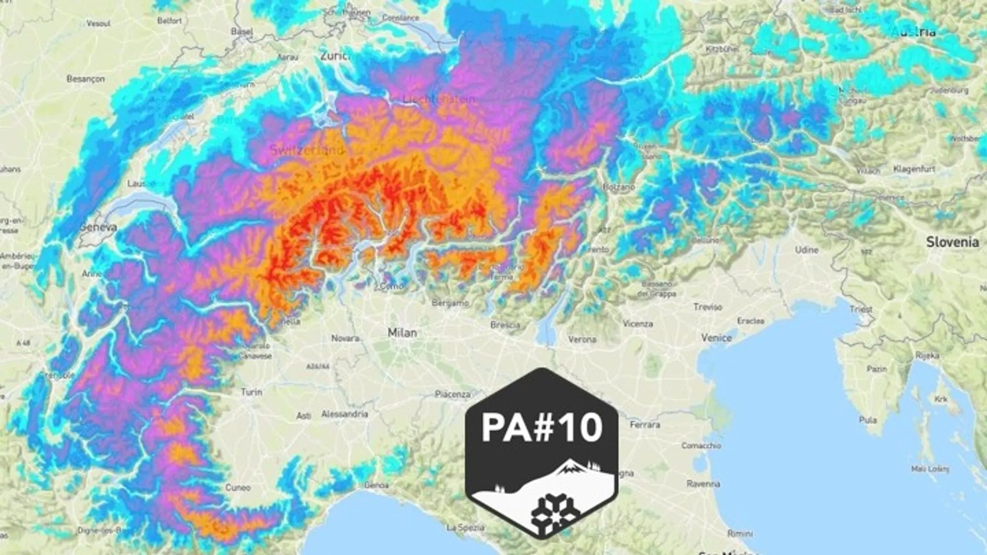
The snowfall from PowderAlert 10 reached the Western Alps early this morning. Plans have been made and quite a few WePowderpeople are already on their way to the mountains — or are already there — to score this fresh powder. It’s great to see the excitement going! Below is an update on this snowfall cycle per region: how long the snow will last, how much is expected according to the latest insights, and when conditions will start to clear again.
The driving weather system
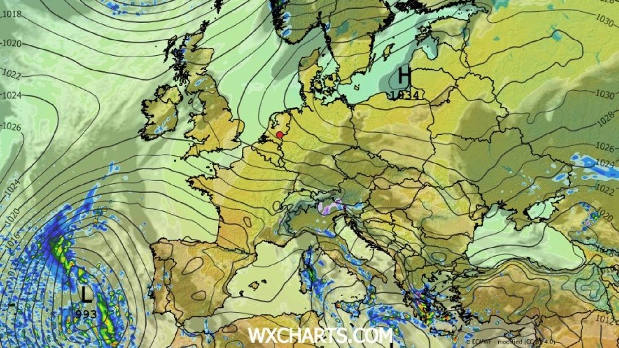
A dominant low-pressure system near Iceland has pushed away the recent high-pressure influence and sent a cold front across western Europe. As this front moved into the Western Alps, a secondary low-pressure system formed between Turin and Nice. This secondary low is expected to drift southward toward Sicily on Sunday and Monday.
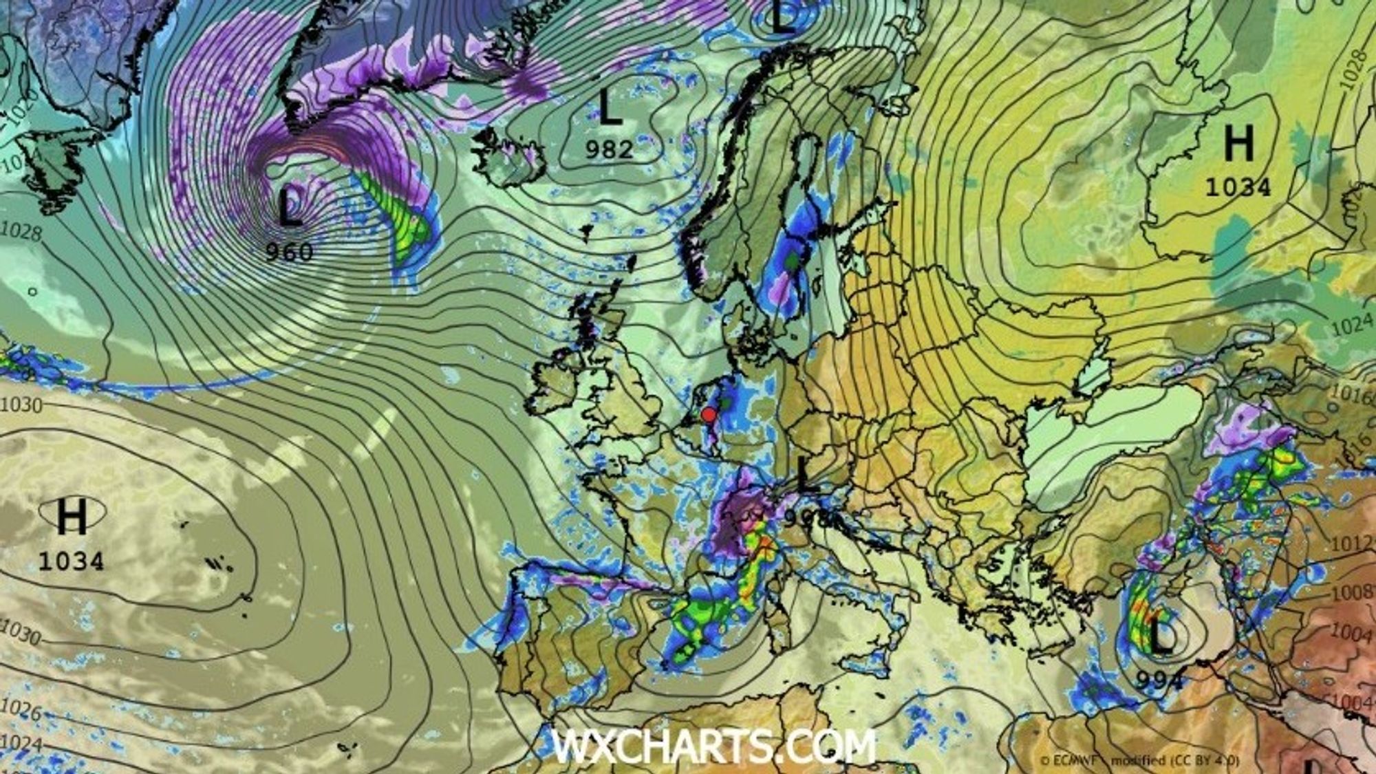
Because of the development of this new low, the cold front crossing the French Alps slowed down significantly this morning. Along the northern side of the developing system the front even stalls and gradually behaves more like a warm front later this weekend as an easterly counter-flow develops. This is exactly why precipitation becomes concentrated over Switzerland and Ticino, where the system temporarily lingers.

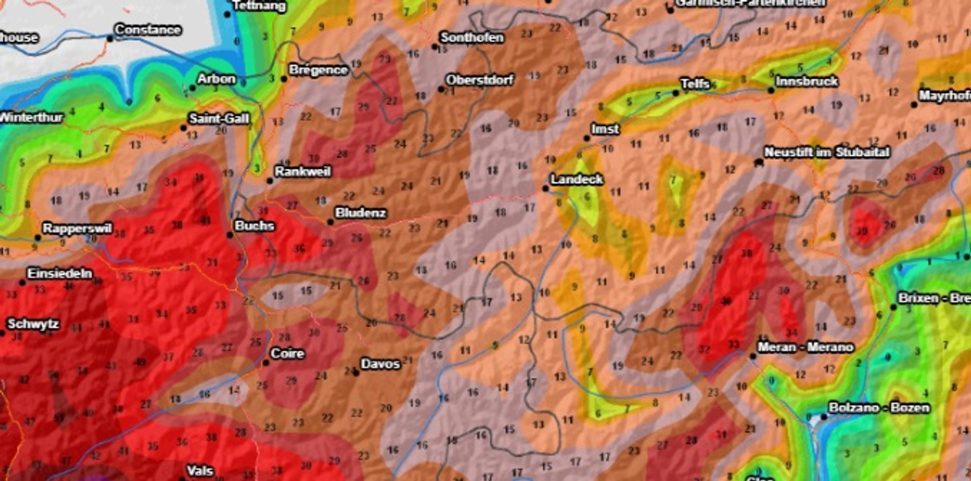
- 1cm
- 5cm
- 10cm
- 15cm
- 20cm
- 30cm
- 40cm
- 50cm
- 75cm
- 100+
- 1mm
- 5mm
- 10mm
- 20mm
- 30mm
- 60mm
- 120+
The French Alps
The first snowfall from PA#10 began early this morning and quickly spread across the French Alps. Initially the snowline hovered between roughly 1300 and 1500 meters, before gradually dropping as precipitation intensified.
Savoie and Haute-Savoie
In Savoie and Haute-Savoie, snowfall became heavier during the morning and the snowline dropped toward 1000 meters by midday. Snow continues through the afternoon and evening, although with decreasing intensity. By the time the event ends, most areas will see around 20 centimeters above 1000 meters, increasing to roughly 40 centimeters above 1500 meters. Around Val d’Isère, totals may locally exceed 50 centimeters thanks to continued snowfall along the main ridge. Check out the avalanche bulletin here
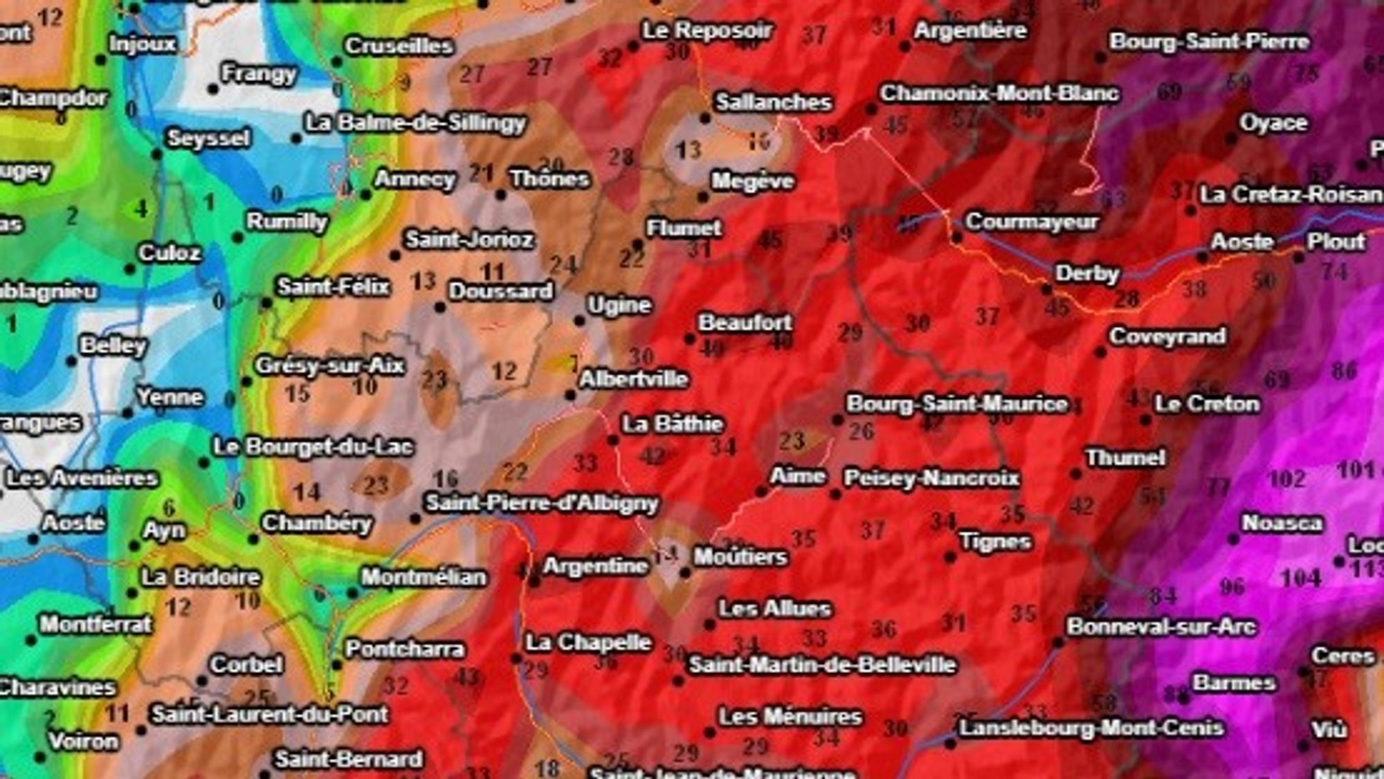
Ecrins and Alpes Maritimes
Further south, in the Écrins and the Alpes-Maritimes, snowfall followed a similar pattern during the morning but the snowline dropped more slowly and conditions became drier earlier in the afternoon. Totals there are expected to range between 15 and 30 centimeters above 1500 meters, with the Écrins likely seeing the most snow and perhaps a local outlier around places such as Abriès. Sunday becomes more influenced by föhn winds, and by Monday skies gradually clear with moderate temperatures returning. For the latest avalanche info look here
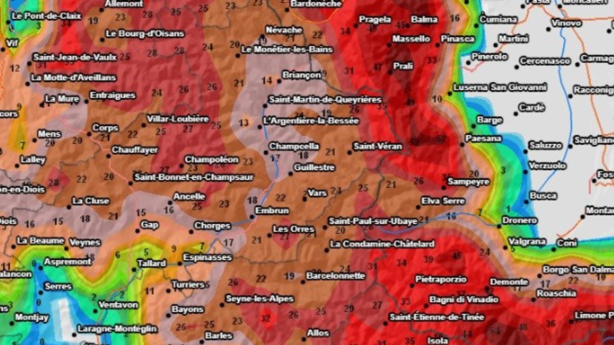
Piemonte and Aosta
On Saturday the precipitation quickly crossed the Alpine main ridge into Piemonte and Aosta. Initially the heaviest snowfall fell north of the Turin–Chambéry highway, particularly above 1100 to 1300 meters, while further south snowfall remains lighter. Unlike the French Alps, however, precipitation here receives a second push on the backside of the low-pressure system, this time arriving from the east. As a result snowfall continues for much longer in northern Piemonte and Aosta, and the snowline gradually drops toward 1000 meters or even slightly lower during the afternoon. In southern Piemonte, snowfall may briefly weaken tonight before intensifying again during Sunday night and Sunday morning. By Sunday afternoon conditions gradually dry out.
Total snowfall across the region is expected to reach 30 to 70 centimeters, and by Sunday morning conditions will already be quite deep. Local outliers approaching one meter of snow are possible along the eastern flank of Piemonte, potentially around Prali, where the pivot point of the precipitation system sets up. Monday then turns sunnier with a light föhn influence and fairly rapid warming, with the freezing level rising to around 2300 meters.
Avalanche danger in parts of Piemonte is forecast to reach Level 4, so checking the local avalanche bulletin before heading out is essential.
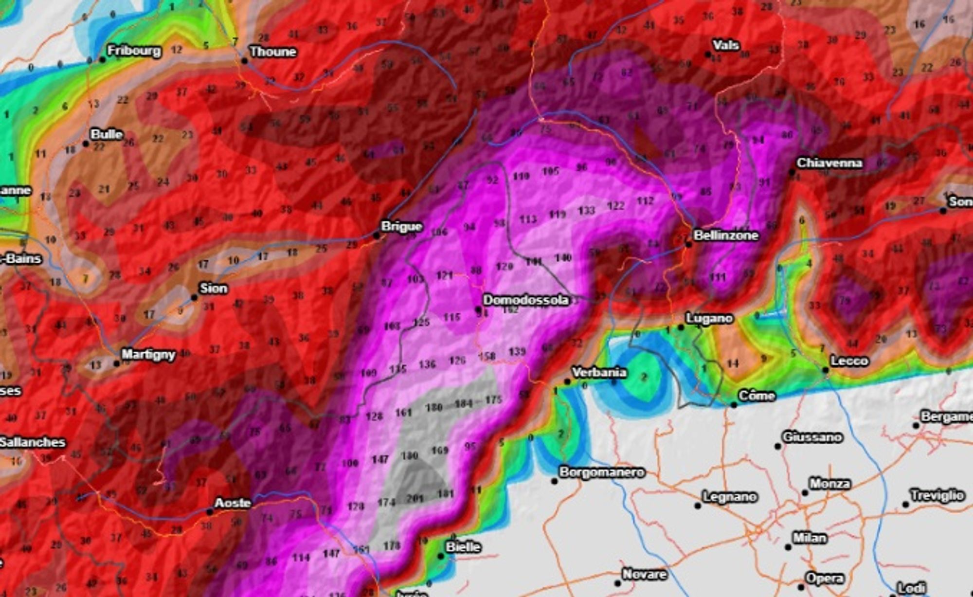
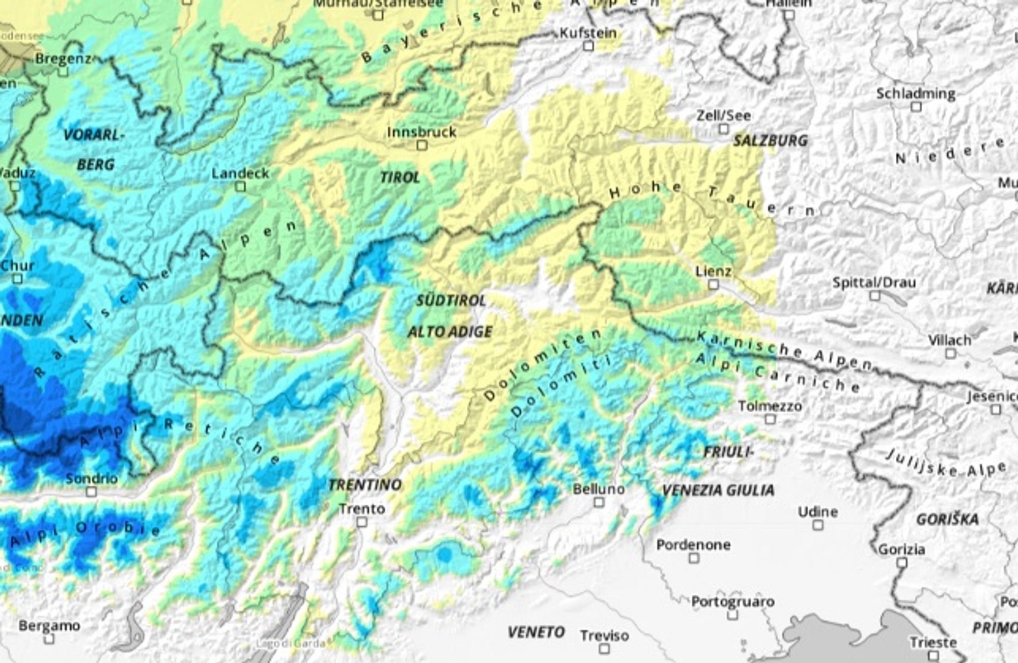
Ticino and the Monte Rosa massif
The real focus of this snowfall cycle lies across Ticino and the Monte Rosa region. Snow began falling here during the night, and by early morning many locations had already measured 10 to 20 centimeters.
Heavy snowfall continues through tonight and into Sunday morning, with the snowline remaining around 1200 meters. By the end of the event many areas will have received 70 to 120 centimeters of fresh snow, while some spots could even approach 150 centimeters. Such large amounts of new snow will place significant stress on the snowpack, especially because persistent weak layers still exist deeper in the snowpack in several regions. Avalanche danger will therefore rise quickly. Make sure you keep an eye on the avalanche bulletin
Chris yesterday already qouted some hotspots:
The largest snowfall totals in Switzerland are expected in Andermatt, Rosswald, Bosco Gurin, Saas‑Grund, Zermatt and Saas‑Fee, with more than a metre and locally even well over 1.5 metres of powder. In Italy, similar amounts are likely in San Domenico, Macugnaga, Craveggia, Alpe Devero and Staffal.
By Monday skies begin to clear here as well, although a light föhn effect will bring fairly rapid warming.
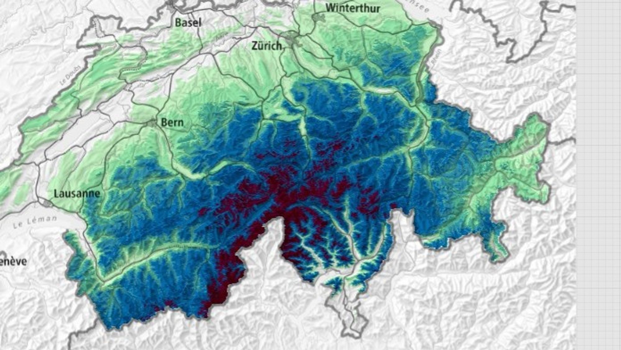
Switzerland (from Diablerets to the Glarner Alps)
With snowfall arriving from both the west and the south, much of Switzerland temporarily falls under the influence of this storm later today and tonight. While the snowline in Ticino remains relatively high, it drops to below 1000 meters across western and northern Switzerland. As a result, many regions — including Val d’Anniviers, Crans Montana, Engelberg and Laax — are expected to receive roughly 30 to 50 centimeters of fresh snow. On Monday a weak cold front brings continued cloud cover and occasional light snowfall above about 1100 meters, though totals remain limited to about 10cm. The warming influence here will therefore be somewhat weaker, but visibility at higher elevations may remain poor.
Austria
In Vorarlberg and parts of Tirol, including the Arlberg region and areas such as Sölden and Obergurgl, snowfall arrives later tonight. The snowline here is already relatively low — around 1000 meters — and by tomorrow morning roughly 20 to 30 centimeters of fresh snow may have accumulated. Cloudy conditions persist into Tuesday morning, while another cold front arriving Monday afternoon may bring an additional 10 centimeters. Further east only a light dusting is expected, as the main snowfall associated with this system does not extend far into eastern Austria.
Dolomites
The Dolomites receive only a glancing blow from this storm. Snowfall does reach the region, but with a higher snowline — initially around 1800 meters, later lowering to around 1300 meters — and more modest totals. Most areas can expect roughly 15 to 30 centimeters of fresh snow. Skies begin to clear again during Sunday, although some light snow showers may still pass through Monday with moderate temperatures.
Wind and avalanche danger
With such significant snowfall totals, avalanche danger will quickly become an important factor. In parts of Ticino and the Monte Rosa region, a Level 4 avalanche danger has already been forecast. Wind will also play a role in the coming days. While there is no particularly strong jet stream event, there will still be enough wind at higher elevations to transport snow and form wind slabs. Because the developing low-pressure system causes shifting wind directions, these wind slabs may form on a variety of aspects — especially along the main Alpine ridge between the French Alps, Piemonte and the Bernina massif.
Check lift openings before you head out to a particular spot to ensure they open, especially in those regions where 50+cm are expected.
What happens next week?
Sunshine returns to most regions early next week, and the rapid warming that will occur in parts of the southwestern Alps will loose its edge. A new high-pressure system is expected to build over the Baltic States, creating an easterly airflow across the Alps with moderate temperatures. Some light snowfall may still occur in the Eastern Alps later in the week, but overall conditions should remain good thanks to clear nights that allow the snowpack to stabilize. Temperatures at 2000 meters will generally remain slightly below freezing, while valley floors will see strong overnight cooling.
If you’re heading out into the mountains, enjoy the fresh powder — and choose beautiful but safe lines.
Reaktionen
somthing is not adding up though. if you look at your map or the top picture, you see a lot of orange / red west of Trento (Brenta Dolomites, Adamello region). then in your second last picture you see what looks much less and you write regarding Dolomites: Most areas can expect roughly 15 to 30 centimeters of fresh snow. …
Well spotted Brechfel. Thanks for letting me know. The differences have to do with the model uncertainties for that area. I should have highlighted that a bit more while I focussed more on the hotspots further west.
Having said that I have just had a look and see 30-40 cm in many spots with locally 60cm near Adamello and Madonna. So indeed it’s adding up significantly!
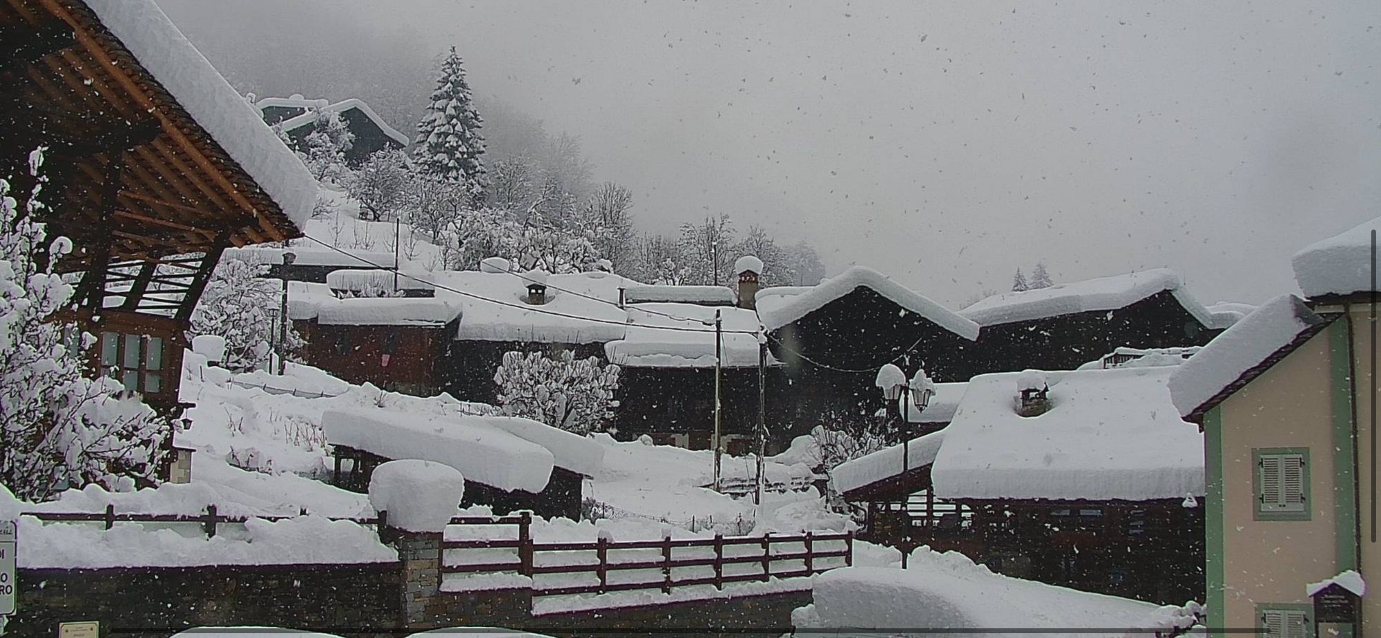
Nice dump in Alagna compared to yesterday mornings webcam pictures in the forecast! Many places exceeding 1m fresh!
219cm of snow at Gabiet but nothing open with warm temps already startinf to affect it.I highly doubt we will be able to ski this snow.closed today and most likely opening after the temps have ruined the snow