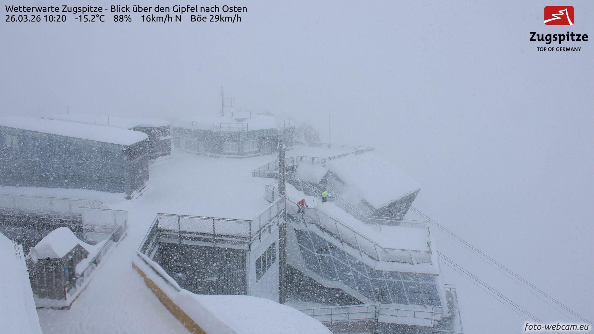
The Nordstau is in full swing and snowfall totals increased significantly today! With the snowline dropping all the way down to the lowest valleys, the winter wonderland has fully returned for now. On the Zugspitzplatt (which is lower and more sheltered than the summit webcam above), around one meter of snow has already fallen according to the measuring station.
Lots of fresh snow and wind
Across a wide area, 40-80 cm of snow has already fallen in the Northern Alps. Above you can clearly see how the Nordstau hit Zürs. The cold front pushed in yesterday later in the afternoon, causing a sharp drop in temperature and a sudden increase in wind. Since then, showers have been piling up against the northern side and the snowpack has been steadily growing.
We already warned about it in recent days, but the wind has also been quite intense today. Many higher-altitude areas were partially or even completely closed, especially regions around the Alpine main ridge and south of it. There, the Nordföhn caused very stormy conditions.
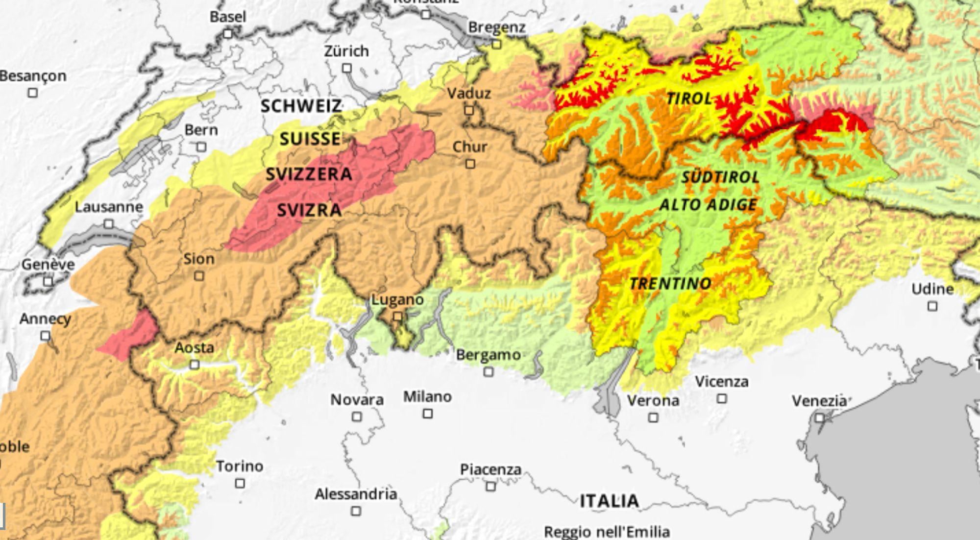
The combination of lots of fresh snow, wind, and in many places the persistent old snow problem has naturally caused avalanche danger to rise significantly. Avalanche danger level 4 applies in Central Switzerland, Vorarlberg, Tyrol, the Salzburg region, and around the Mont Blanc massif, while elsewhere it is widely level 3. Here’s a quote from the Zillertal Alps as an example:
As a consequence of new snow and a storm force northerly wind, sometimes large wind slabs formed in all aspects. In addition further wind slabs will form. These can be released easily. or in isolated cases naturally, above the tree line. Individual avalanche prone locations are to be found in areas close to the tree line and below the tree line. Avalanches can be triggered in near-surface layers and reach large size in isolated cases. Additionally in some places avalanches can penetrate near-ground layers of the snowpack, especially on west, north and east facing slopes above approximately 2200 m. Remotely triggered avalanches are possible. The danger exists primarily in alpine snow sports terrain.
What’s next?
What happens next? On Friday, snowfall will quickly decrease from the west. The morning will already start sunny in the Western Alps, while in Austria it will continue snowing for longer. However, there too the intensity will fade during the day, except for the far eastern regions where snowfall may persist into the evening. Not much more will be added, but still around 10-20 cm overnight, with up to 30 cm locally possible in the east.
It will remain nicely cold in the coming days, as also visible on the temperature map at 1500 meters. Saturday will start mostly sunny everywhere thanks to a temporary high-pressure ridge. A beautiful winter day for late March, but keep a close eye on the avalanche danger. This good-weather window won’t last long, as increasing cloud cover will move in from the northwest Saturday afternoon, followed by another precipitation front.
- -20°
- -15°
- -10°
- -5°
- 0°
- 5°
- 10°
- 15°
- 20°
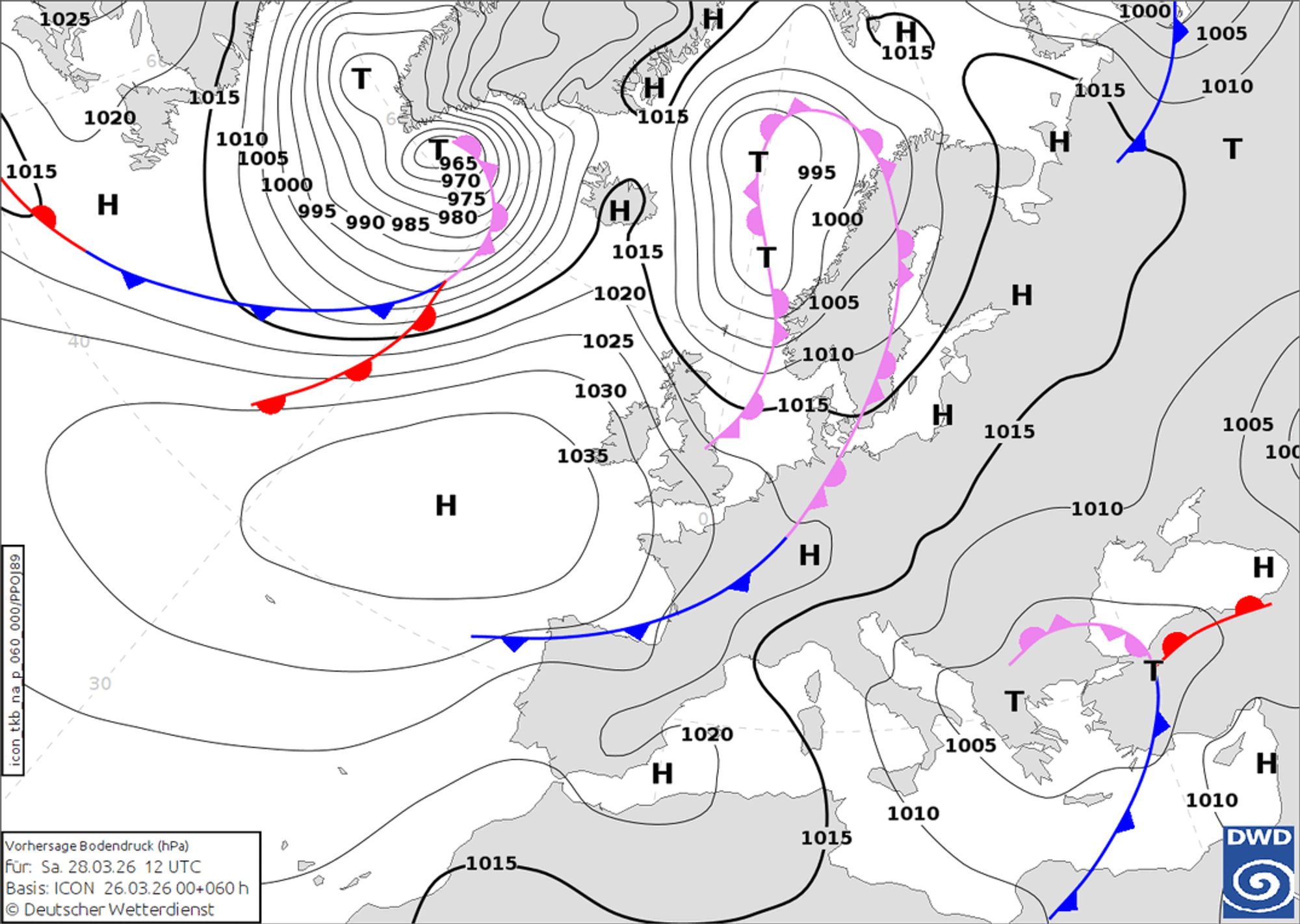
From Saturday night into Sunday and during Sunday, snowfall will return to the northern side. Widespread amounts of 10-20 cm are expected, with up to 30 cm regionally in Switzerland. Cold air remains in place, so the snowline will again drop into most valleys. Due to a new high-pressure influence, snowfall will stop from the west during Sunday. In Austria, it will continue snowing longer, but with decreasing intensity.
New PowderAlert next week?
As Coen already mentioned yesterday, more snowfall is expected next week. The ECMWF model seems to be backing away from the earlier concern about warmer air seeping in, but differences in snowfall amounts compared to the GFS model (which shows a major hit for Austria in its latest main run) are still too large to issue a new PowderAlert at this time. We’ll keep monitoring it over the coming days. For now, the forecasts still look best for Austria.