Over the past few days it was finally on for the Northern Alps. A serious Nordstau delivered large amounts of snow, with the core over Austria and Switzerland. At several Austrian stations, the deepest snowpack of this winter so far was recorded. Along the northern flank, more than 40 centimetres fell across a wide area, and thanks to low temperatures it came down as light, dry powder.
In multiple regions, snow totals even exceeded 50 centimetres, while conditions around the Zugspitze turned outright extreme, with a full metre of snow in just over 24 hours. Today we take a closer look at how this fresh snow is distributed. And this late winter epidose is nog over yet: two new Nordstau phases are already lining up, bringing freshies on Sunday and Tuesday, especially along the northern Alps.

From the Alpine footfills to the highest peaks along the main ridge: winter is fully back (photo-webcam.eu)
Nordstau fuels hopes for a long season
In the French and Swiss Alps, there were already regions with a solid base for the ski touring season, which in these areas can often be extended well into May and even June. Now that spring weather is temporarily on pause, and northern regions are also picking up fresh snow, the base there is growing rapidly as well. Over the coming days the snow line will creep up slightly, but remains low enough for virtually all ski resorts.
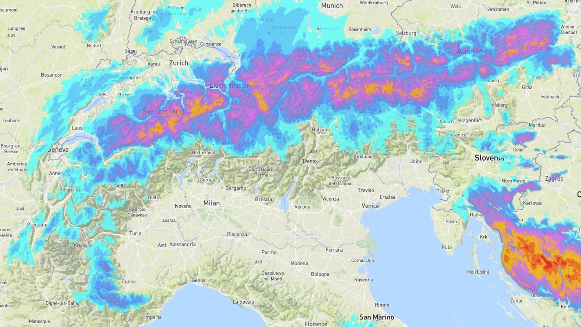
Over the past 48 hours, a notable cold front moved through first, bringing a widespread refresh. This was followed by the development of a NW stau, which yesterday transitioned into a classic Nordstau. That’s when the party truly began in Switzerland and Austria. The focus of precipitation gradually shifted towards the eastern Alps, but even today light snowfall can still occur here and there along the entire northern flank.
- In Switzerland, more than 50 cm of fresh snow fell widely, with peaks up to 80 cm
- In Austria, 50+ cm was recorded in parts of Vorarlberg and a band across the Northern Alps, with local extremes of 80-110 cm
Storm + snow = avalanche danger
Not only did we receive a substantial load of snow, the wind also made its presence felt. Especially yesterday, when many ski resorts kept their lifts closed as a precaution. During snowfall, winds were stormy at elevation, with gusts exceeding 80 km/h. South of the main ridge, a strong Nordföhn developed, with wind gusts of 100 to 130 km/h recorded up to this very moment. On the northern side, winds have eased significantly, though gusts around 50 km/h still occur locally.
The consequences are obvious: wind slabs, wind crusts and rising avalanche warning levels. Avalanche level 4 is in force today around Chamonix, in the central Swiss Alps, and in parts of Austria above the tree line:
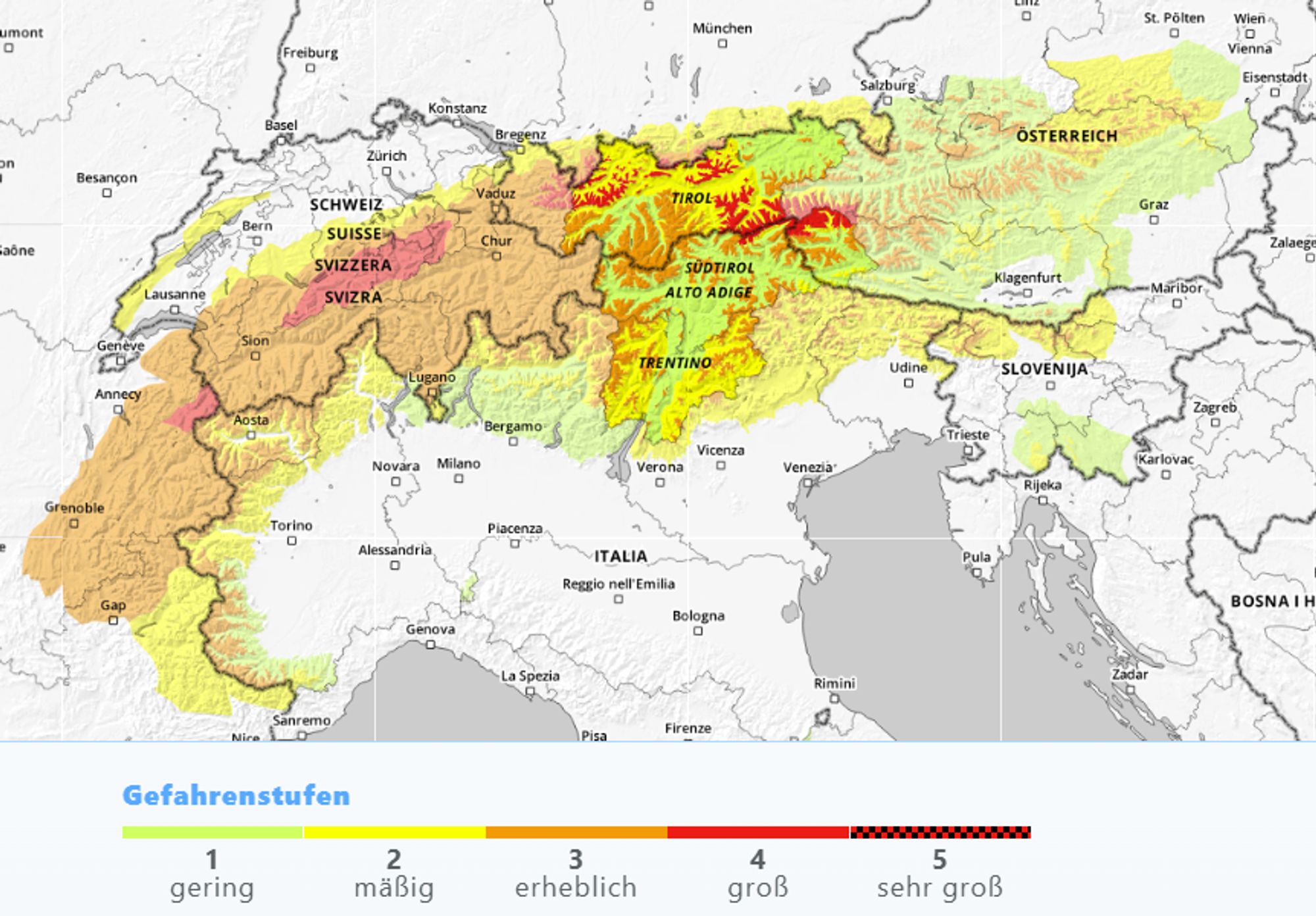
The Avalanche Bulletin for Vorarlberg desribes the current setting as follows:
Since Wednesday, 60 to 70 centimetres of new snow have already fallen. Snowfall was accompanied by strong to stormy northwesterly winds, leading to the formation of large and easily triggered wind-drifted snow accumulations in places. In between, there were repeated graupel showers. Overnight, another 10 centimetres of new snow is expected under continued wind influence. New snow and wind slabs rest on a loose surface on shady slopes, while on sunny aspects they lie on a melt-freeze crust. Beneath another melt-freeze crust in the upper third of the snowpack, faceted crystals are present locally. The middle part of the snowpack consists largely of well-set, compact layers, which overlie a weak old snow base on shaded, higher-elevation slopes.
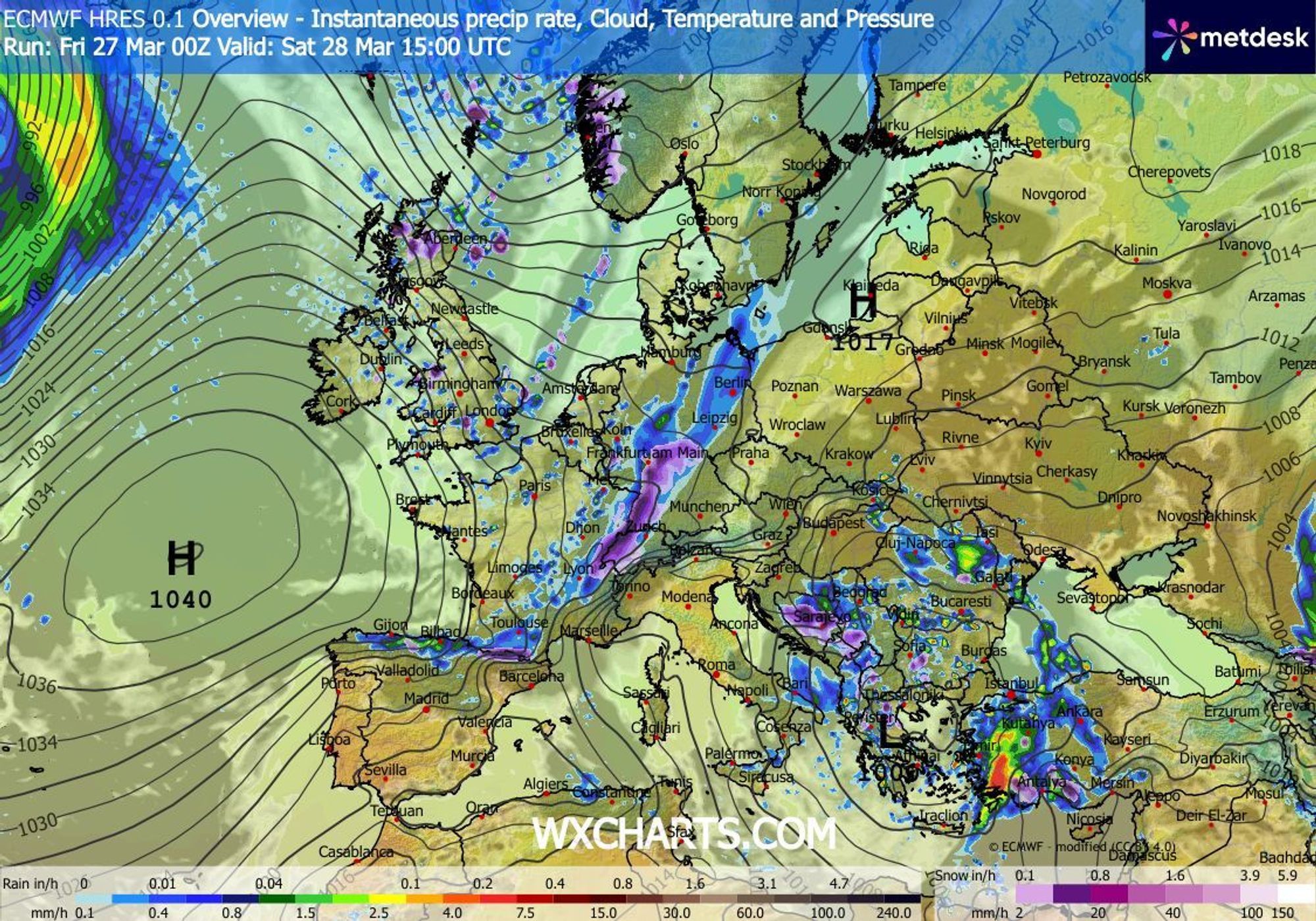
Another round of snow from the northwest on Saturday evening
An extension of a large high-pressure system over the ocean moves across the Alps during the night and morning. Winds ease significantly everywhere, and temperatures plunge well below freezing, even into the valleys. In sheltered high valleys, temperatures may drop below -15.
Meanwhile, a new ridge extending towards Iceland has already set another batch of polar air in motion. The leading edge is marked by a cold front, which will bring renewed snowfall during the evening and night, mainly in Switzerland and Austria, north of the main ridge, from about 1000 metres.
During Sunday daytime, it turns dry again from the west, though light snowfall may persist in Austria until the afternoon. Most weather models project 10 to 25 centimetres of fresh snow this weekend, with precipitation reaching less far south than in recent days due to a weaker flow.
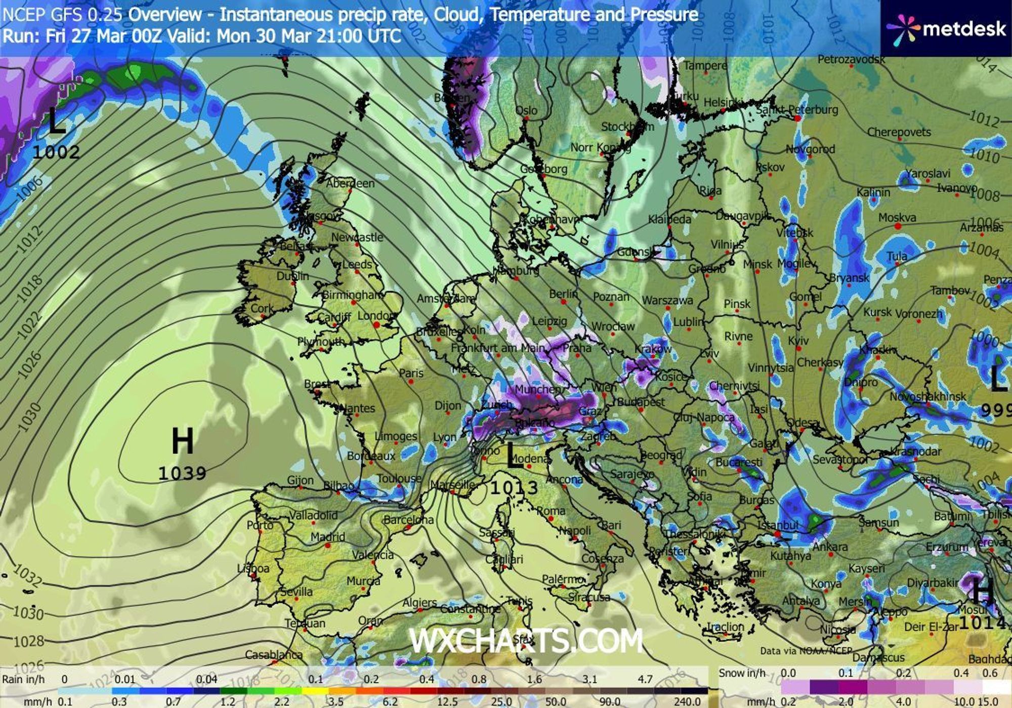
Potential dump early next week
A bit of déjà vu, you might say, though from Monday afternoon onward the setup looks more active than over the weekend. The flow turns back to northerly directions, with strong Nord- to Nordweststau signals, especially for Switzerland and Austria. This pattern has the potential to deliver another half metre of fresh snow, down to relatively low elevations.
There’s a good chance we’ll be issuing PA #13 this weekend. Watch this space. Enjoy the powder over the coming days - and play safe!