In this short update we zoom in on the snowfall from this PowderAlert. How much has already fallen, what’s still to come—and when will the sun break through?

Snowfall so far
Yesterday morning the front of PA#13 reached the Swiss Alps. After a hesitant start, it has been dumping steadily since yesterday afternoon. Austria joined a bit later, and the French Alps also saw snowfall. Let’s run through the regions:
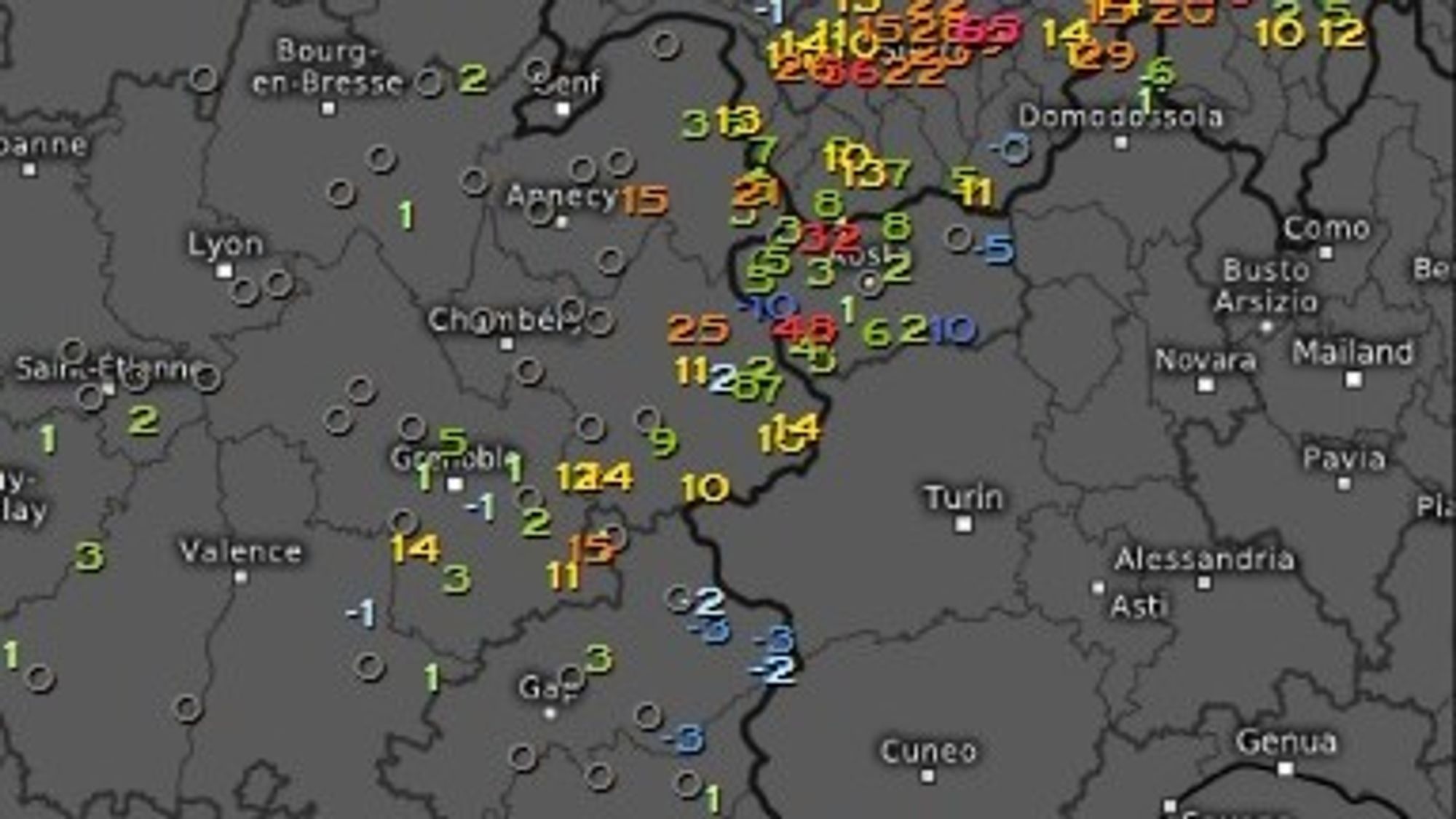
French Alps
In Savoie and Haute Savoie, around 10–20 cm fell by this morning, down into the higher valleys. Local spikes above that.
Swiss Alps
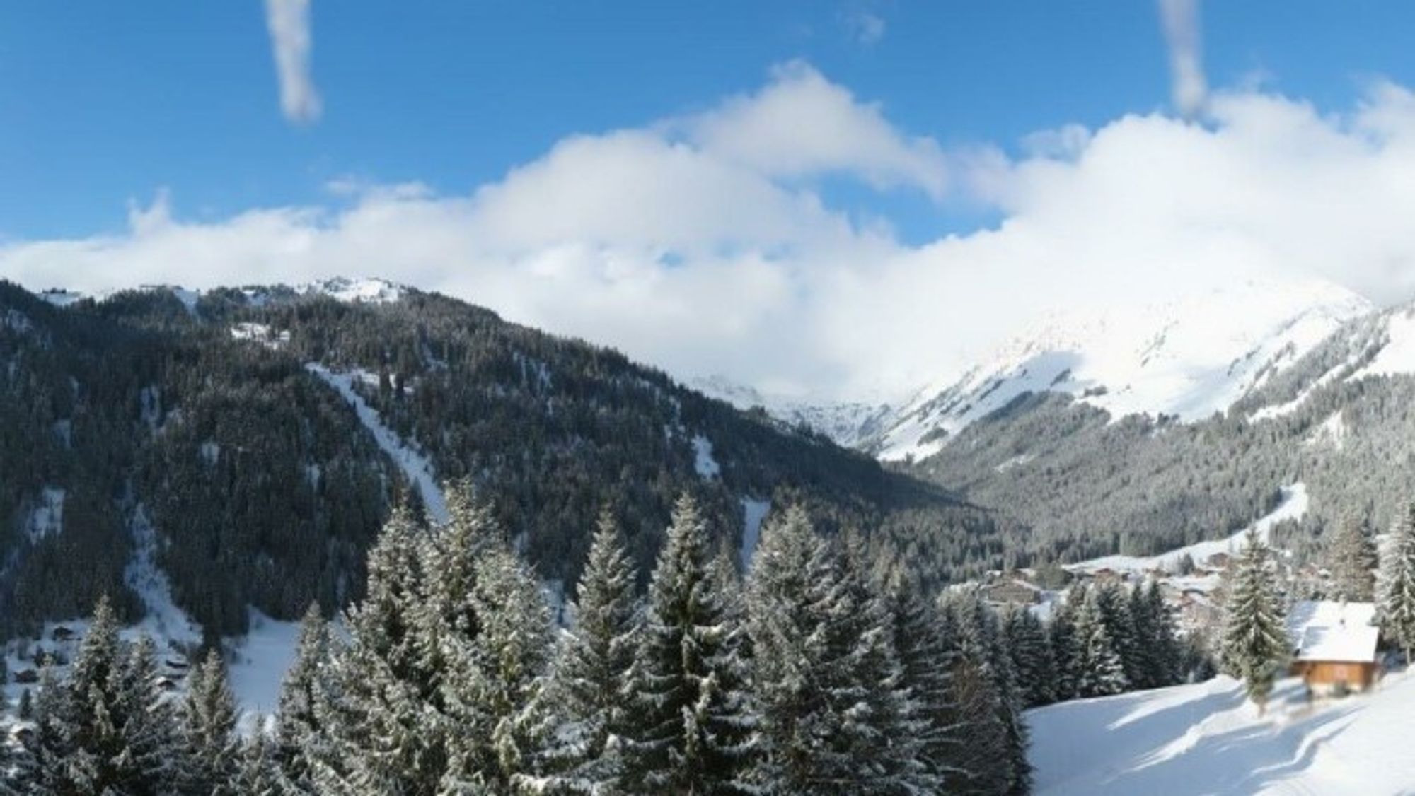
The northern Alps of Switzerland—from the Berner Oberland to Liechtenstein—are the big winners so far. From Les Diablerets to the far east, 40–75 cm has been reported (think Adelboden, Engelberg). The snowline stayed nicely low (see the webcam from the road to Engelberg at 800 m). Disentis is also delivering as a hotspot, just as flagged in earlier forecast charts, with 53 cm.
More central regions picked up less, but still offer a solid layer of fluffy powder: Val d’Anniviers reports 20 cm, Andermatt 30 cm, Davos 22 cm. The far south only saw a thin refresh of 5–10 cm.
Austria and Germand border
Snow arrived later here, but it has been snowing steadily in the north. Along the entire northern rim—from Vorarlberg to Salzburg—20–30 cm has been reported this morning, with top amounts around and north of the Arlberg up to the Zugspitze region (around 40-45 cm).
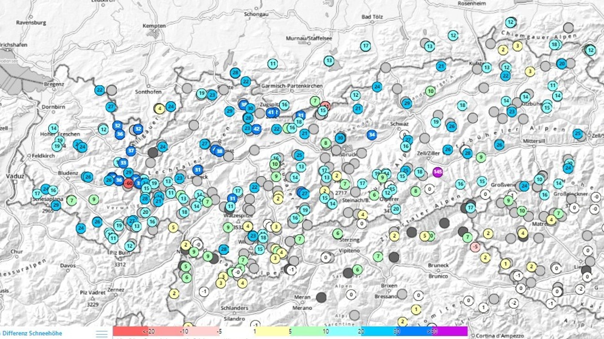
Regions a bit more sheltered behind the first mountain chains also did well, with 15–30 cm in areas like Montafon, Stubai, Hintertux, Zillertal and the Tauern range.
What’s still to come?
Clearing has already started in the French Alps, while snow continues today in Switzerland and Austria—especially from Les Diablerets eastwards along the northern Alps. Expect another 10–20 cm during the day, and an extra 5–10 cm tonight in Austria.

All in, the hotspots in Switzerland and northern Austria will land somewhere between 50–80 cm, with a lucky few spots possibly nudging the 1-meter mark. Slightly less than estimated over the weekend, but still a serious dump and proper cold smoke.
Up high, the wind has had its say. With strong winds—gusts up to 60–70 km/h above treeline, and even stronger locally due to a northerly föhn—snow has been redistributed and compacted in places.
Avalanche danger
In all regions with fresh snow—and also in the south due to wind transport—the avalanche danger is at least level 3, rising to high in the snowiest parts of Switzerland and Austria. Report below is from Arlberg but can be almost copy pasted for Northern Switzerland.
By Tuesday morning, up to 40 cm of fresh snow was registered across wide areas, locally up to 50 cm. With intermittent strong winds, this snow has been transported, forming fresh drifted slabs that are prone to triggering. These drifts often sit on top of soft layers from previous days, and also cover older wind slabs. Mid-pack layers are generally well consolidated, but on shaded slopes they rest on a weaker, poorly structured base.
Outlook: rapid warm-up in the weekend
High pressure is slowly expanding over the Alps from the west. The process is gradual, allowing for some light snowfall to linger in Austria (especially Salzburgerland). Elsewhere, clear spells will take over and temperatures will start to rise.
The warm-up continues into the weekend. Morning lows on Thursday will still dip below -5°C, but by the weekend temperatures in the valleys will climb to 15–20°C. A sharp transition—going from powder to slush.