What a fantastic week we’ve had! Two Powder Alerts in quick succession and the snowiest period of the season in the Northern Alps. Temperatures also stayed at midwinter levels. Today we take stock and look ahead to the Easter weekend. Warming will be slow over the coming days, but from Saturday spring will return in full force.

PA#13 totals
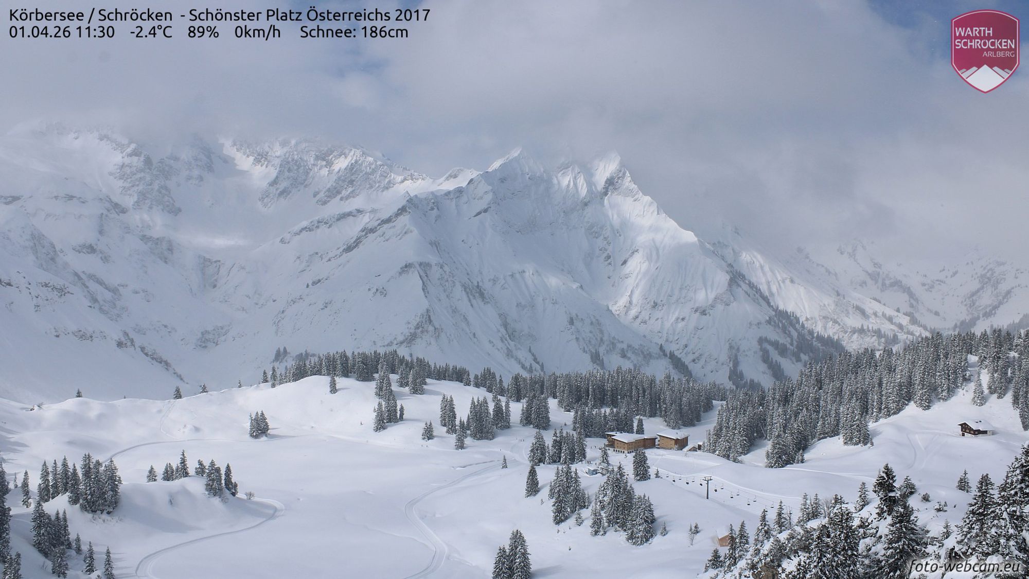
The dump for which we issued PA#13 started slowly and faded even more gradually. Many regions in the Northern Alps received more than a meter of snow in three phases over the past week. PA#13 delivered 30-60 cm in Austria and 40-120 cm in Switzerland over the past few days.
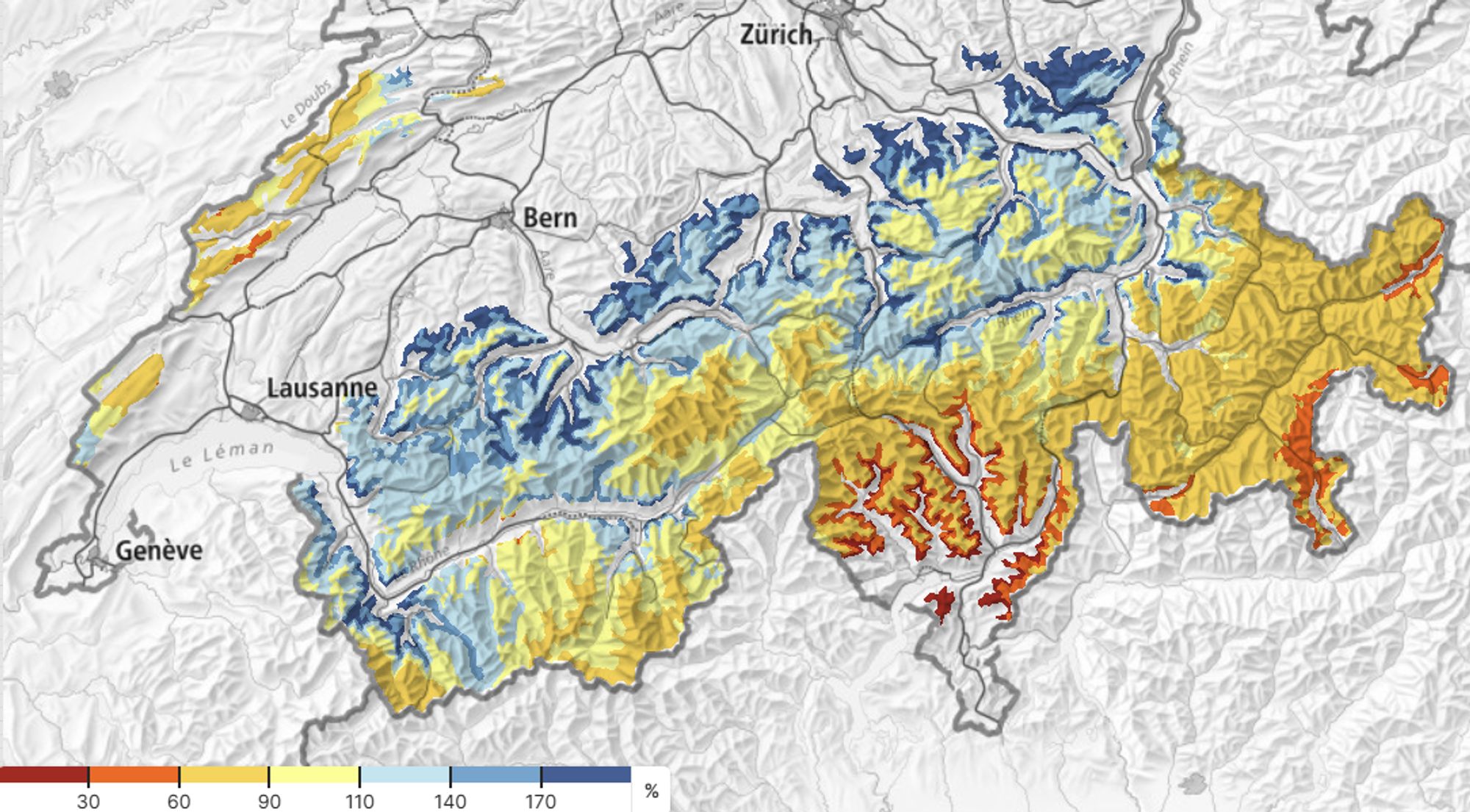
The Swiss Northern Alps received half a meter to well over a meter in the past three days (image 1). Over the course of a week, 1 to 2.5 meters fell (image 2). Austria saw 30–60 cm over 72 hours.
Good conditions expected this month in the Northern and Western Alps
During the most intense precipitation on Monday and Tuesday, the snow line dropped to midwinter levels (500–800 meters). Of course, it is already spring, which means melt sets in quickly at those elevations as soon as precipitation weakens. Strong (diffuse) solar radiation will also rapidly take its toll on the fresh snow at mid-mountain elevations. Today and tomorrow morning there is still plenty of powder to be found. From tomorrow afternoon onward, temperatures will gradually rise and you’ll need to head higher into the mountains for dry snow.
Temperatures on Thursday and Friday will remain moderate, with a freezing level around 1500 meters in the Northern Alps. In the south it is milder, but the air is dry, limiting melt rates.
Over the weekend, the snowpack will largely have settled at altitude and disappeared below roughly 1300 meters. Higher up, however, the past week has made a durable contribution for the late season. Above 2000 meters - and regionally also lower on north-facing slopes - April promises to be a month full of opportunities, despite the milder weather on the way. The total snowpack at altitude in the French, Swiss, and Austrian Northern Alps is now around average. The Southern Alps have not seen a dump in some time and the base there is 20 to 60 percent thinner than normal.
Powder avalanches give way to wet-snow avalanches
Last week, avalanches occurred once again, mostly of the dry type, with unfortunately several fatal accidents. The situation was, however, less tense than during earlier dumps. This has to do with the fact that precipitation fell over longer timeframes this time, and the persistent role of the weak layer is diminishing.
The warning level briefly reached 4 in some regions and has now been downgraded to 2 to 3. Above the tree line, the danger of new-snow avalanches remains elevated today and tomorrow in the Northern Alps. South of the main Alpine ridge, level 3 is also in effect; there the main cause is the föhn storm, which produced large amounts of wind-drifted snow (Triebschnee).
With rising temperatures, avalanche danger in the high mountains will gradually decrease over the coming days. Below about 2000 meters, however, spring sunshine will increasingly cause wet-snow avalanches, especially from Saturday onward.
Mild from Saturday onward
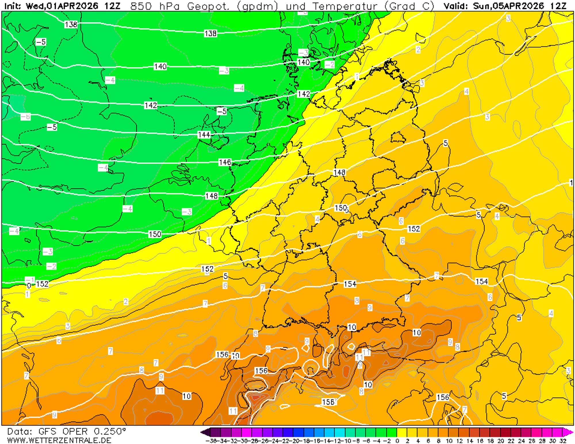
As mentioned, Thursday and Friday will still be moderately cold for April, with a (north-)easterly flow and a freezing level between 1400 and 2000 meters. The cold (north-)easterly wind will ease on Friday, allowing milder air from the southwest to gain ground. Sunshine increases and the Easter weekend looks set to be sunny and distinctly mild everywhere.
On Saturday, expect a freezing level around 2000 meters in the inner-alpine regions of Austria, to about 2400 meters in the Western Alps. Sunday takes it up another notch, with thawing expected everywhere up to 2500 to 3000 meters. Valley temperatures could reach around 20 degrees.
Monday’s weather remains somewhat uncertain. The Northern Alps may be more prone to cloud cover and less mild air, while the Western and Southern Alps are likely to see another spring day.