After a long period of relatively mild and dry weather, a surge of polar air will finaly descend into the Alps at the very end of the season. In addition, we will be dealing with frontal precipitation and showers moving in from the north and west. In this late Powder Alert, I’ll provide insight into the areas where lifts are still operating and how much fresh powder you can expect there this week.
April’s extreme melting partly offset by May dump
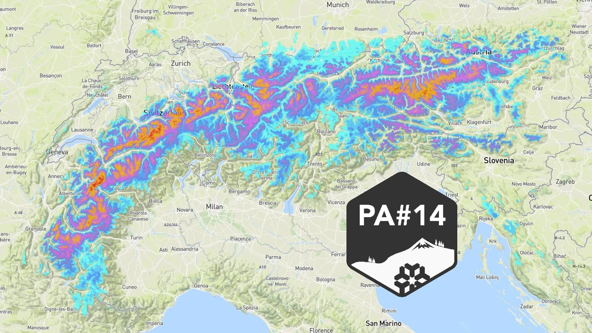
April was a month to forget quickly. Although there was plenty of sunshine with excellent conditions for touring and spring skiing, the snowpack suffered considerably from the warmth. Several mountain passes were able to open very early, and even on some glaciers the ski offering was scaled back prematurely. After the last dump (on March 30 and 31), there was no further significant snowfall. Today the change is already noticeable with snow from around 2000 metres. The snowline will drop significantly on Tuesday, and from Thursday new precipitation will follow, with a snowline low enough for the glacier areas.
This is not only good news for the glaciers, which are once again at risk of becoming snow-free very early, but also for die-hards looking to score powder lines this week. That should be possible on several days this week in the following areas:
Austria
Kaunertal Glacier – Open until May 17 – Currently 3 lifts and 11 runs open
Stubai Glacier – Open until May 17 – Currently 6 lifts and 6 runs open
Kitzsteinhorn – Open until May 25 – Currently 9 lifts and 11 runs open
Mölltal Glacier – Open until May 31 – Currently 4 lifts and 6 runs open
Hintertux Glacier – Open until July – Currently 9 lifts and 32 km of pistes open
Switzerland
Zermatt Matterhorn Paradise – Open year-round – Currently 21 km of pistes open
Winter conditions temporarily down to around 1000 metres
If you are travelling by car in the Alps, you should take winter conditions into account tonight and tomorrow (Tuesday). Strong northwesterly winds are expected, and the snowline will drop to around 1000 metres. Make sure you have winter tyres and snow chains, and check whether your route is clear before departure.
20-40 centimeters - best conditions on Wednesday morning
Above 2000 metres, around 10 cm has already fallen today in Austria, and another 10 to 30 cm will be added overnight and during Tuesday. This precipitation is associated with a cold front passing overnight, followed by several clusters of showers. On Wednesday, a break in precipitation will occur under a ridge of high pressure. Especially in the morning, there will likely still be abundant powder under favourable weather conditions. Take into account the avalanche risk, especially if you’re venturing into the backcountry or planning steep descents. There will be wind, and conditions can change rapidly in the coming days!
Webcams already show fresh snow in the high mountains today (foto-webcam.eu)
Another 20-40 cm possible from Thursday
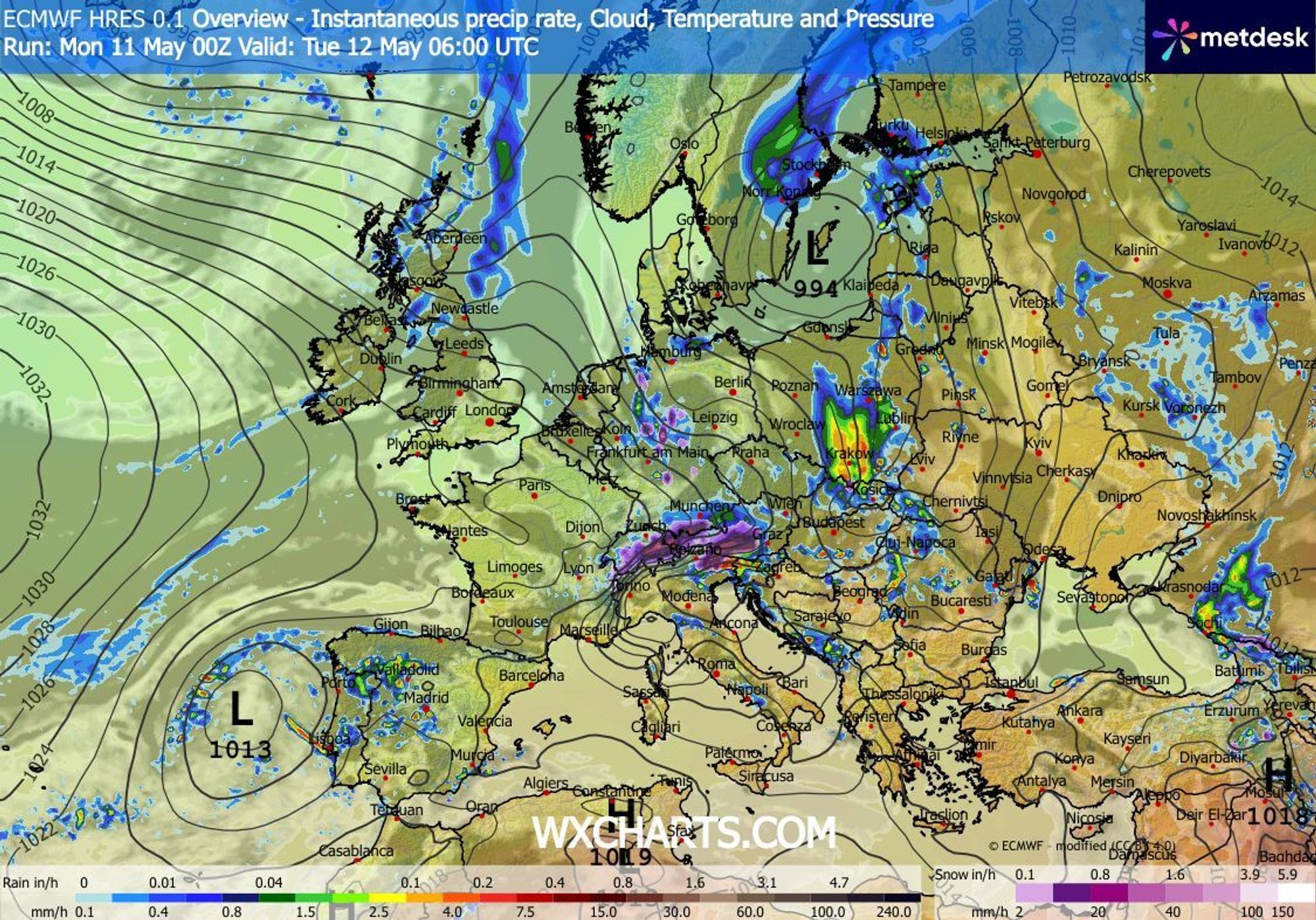
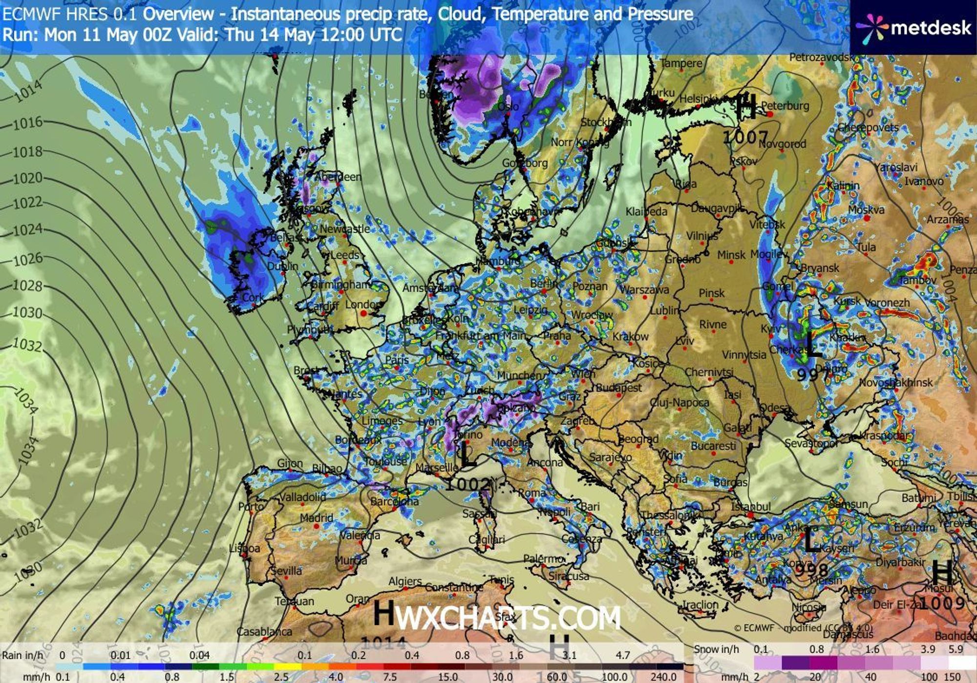
The ECMWF chart below for Thursday shows that we will once again be presented with a northwesterly flow. Other weather models indicate the same development. A cold front will again be followed by a NW stau, bringing significant precipitation, especially to Austria and Switzerland. The situation is fairly complex, however, as a Genoa low may develop, which could influence the snowline and precipitation distribution. For now, it looks like snowfall will resume from around 1500-2000 metres. We will continue to monitor the situation closely and will likely provide another update for this second phase of precipitation.
Reaktionen
List of resorts with lifts still turning in order of open pistes if anyone tempted:-
https://www.skiresort.info/snow-reports/europe/sorted/open-slopes/