In the coming days, a northwesterly flow with polar air will develop, which will start to take hold in the Alps from Wednesday onward. Most of the snowfall will likely be in Austria this time, where the NW‑stau shifts into a nordstau that persists for quite a while. In this Powder Alert:
- When will it start snowing, and when will it turn dry again?
- What will happen to the snow line during this period?
- The impact of fresh snow and wind on the avalanche situation.
- Where to go?

A local snow shower, Tuesday dry and milder
Monday brings a mix of clouds and sunshine with little wind. Because the upper air is still fairly cold, a few springtime showers may develop, producing a dusting of snow locally above 1500 meters. The French Alps remain dry.
On Tuesday we find ourselves on the leading edge of the system that triggered PA #12. As usual, slightly milder air moves in first, making the contrast from Wednesday evening onward all the greater. The freezing level sits around 2000 meters on Tuesday. After a sunny start, high clouds gradually increase.
Cooldown and snowfall from Wednesday afternoon
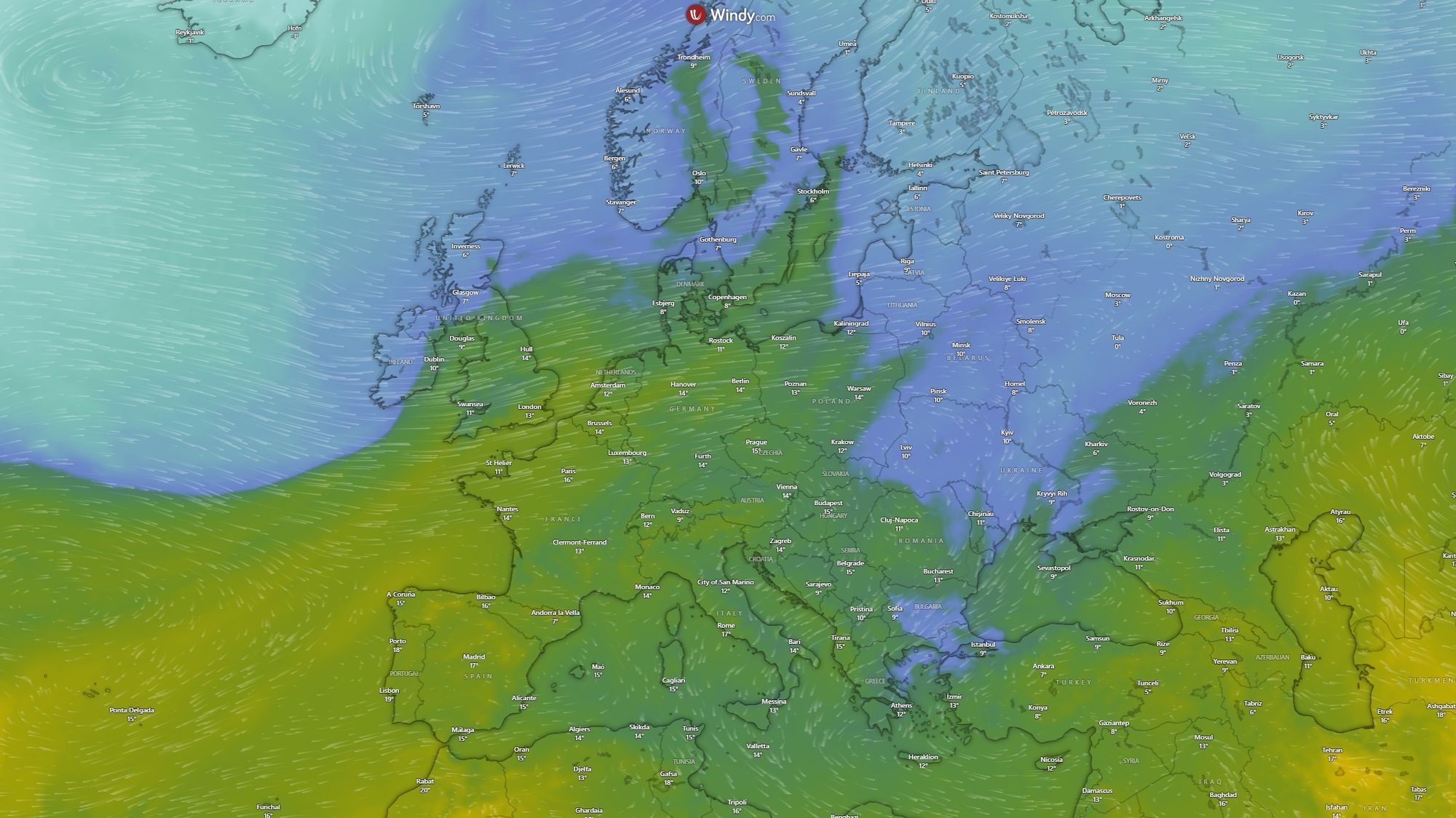
A lot is happening on the weather maps on Wednesday. A large high-pressure system centered near the Azores extends a ridge toward Iceland. At the same time, pressure drops over Scandinavia and a small low develops over northern Italy.
At first, the mild air that moved in on Tuesday is still present. With hazy sunshine, the freezing level rises to around 2000 meters and valley temperatures reach about 15 C. In Switzerland and the French Northern Alps, clouds thicken quickly, and by late afternoon and evening the rest of the Alps follow. Precipitation follows the same pattern, with the first flakes and drops appearing in the second half of the afternoon, spreading across the Alps during the evening.
Cold front sends the snow line plunging
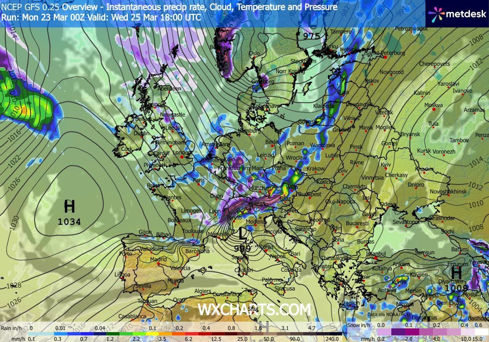
The maps below show the evolution of the snow line from Wednesday afternoon onward. The first precipitation may fall as rain up to around 1700 meters, but temperatures drop rapidly. Within a few hours, it will be snowing down to the lowest valleys (around 400 meters) in Switzerland and France. Under the influence of the low over northern Italy, the cold air arrives a bit more slowly in Austria and the eastern Southern Alps. Even so, the snow line there drops toward 1000 meters on Wednesday evening and toward 400 meters on Thursday morning. On Friday the snow line remains nicely low at 400-700 meters, and only on Saturday does it rise above 1000 meters again - by then most of the precipitation has passed.
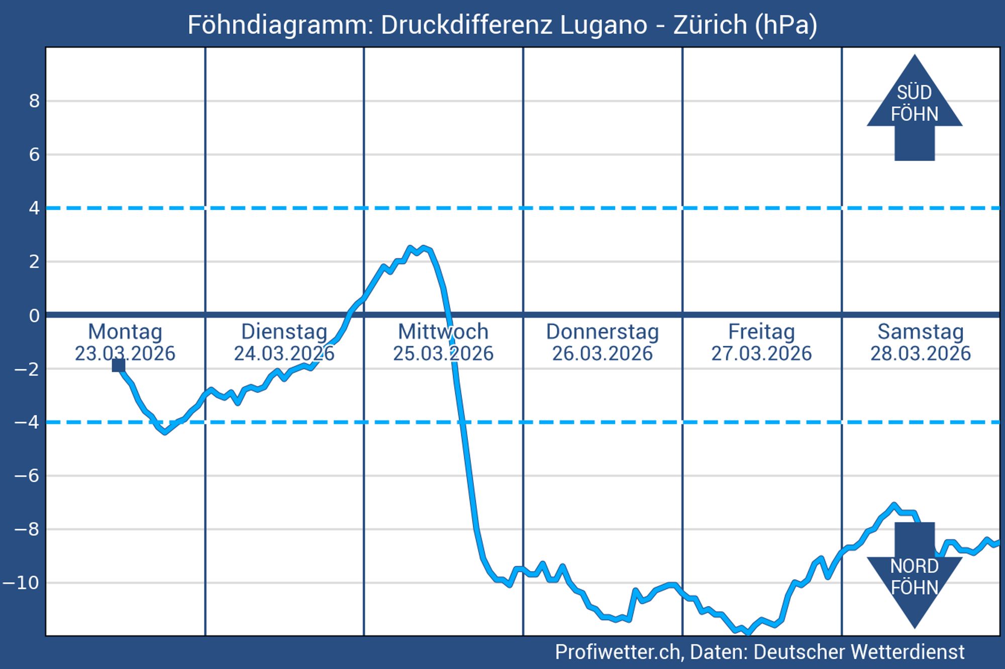
First südfohn, later nordfohn
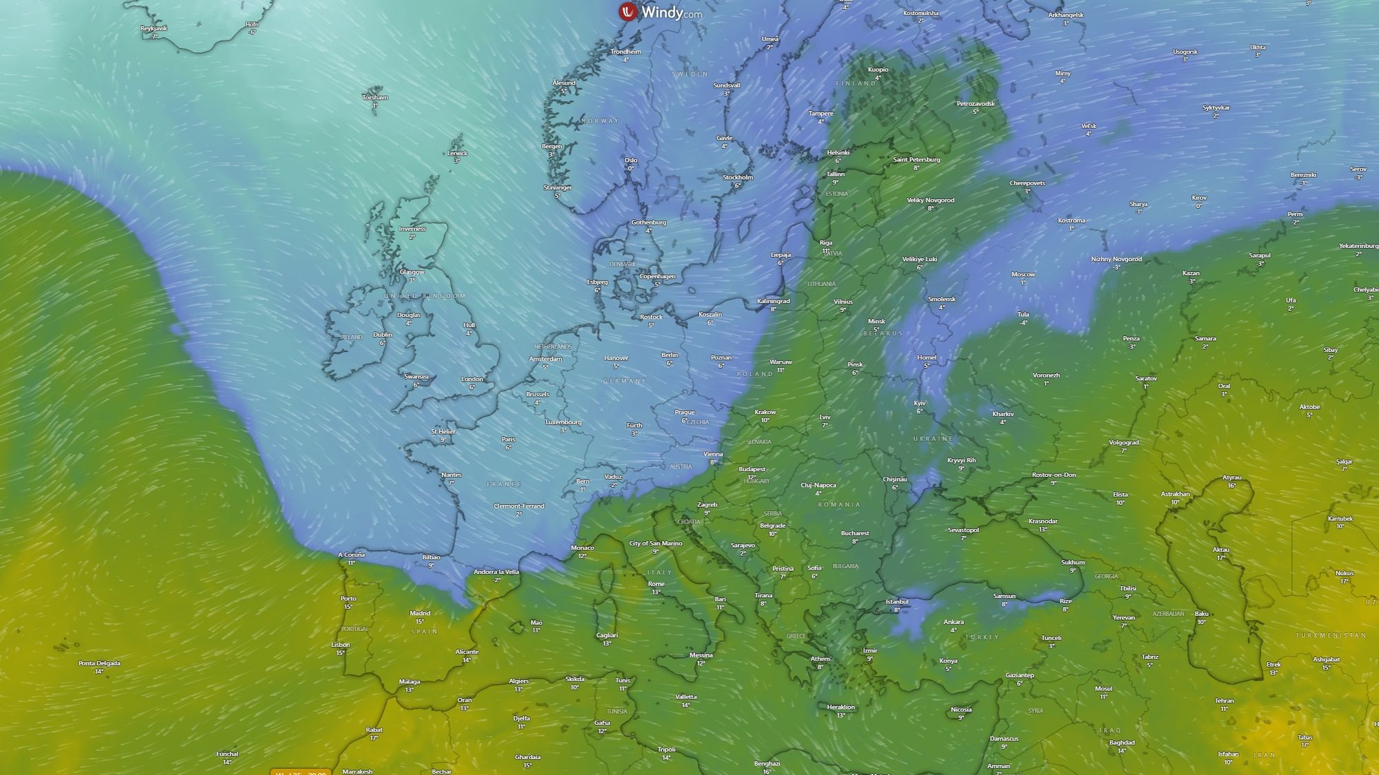
On Wednesday, a südfohn develops in the Northern Alps. Ahead of the cold front, wind gusts up to 80 km/h are possible in Switzerland and Austria. After the front passes, the wind shifts to northwest and later to north. This shift is visible in the föhn diagram below, which also shows that the northerly flow will persist for several days. During these days it will be windy at higher elevations almost everywhere, with föhn conditions in the Southern Alps and a strong north(westerly) wind along the northern side, where most of the snow will fall.
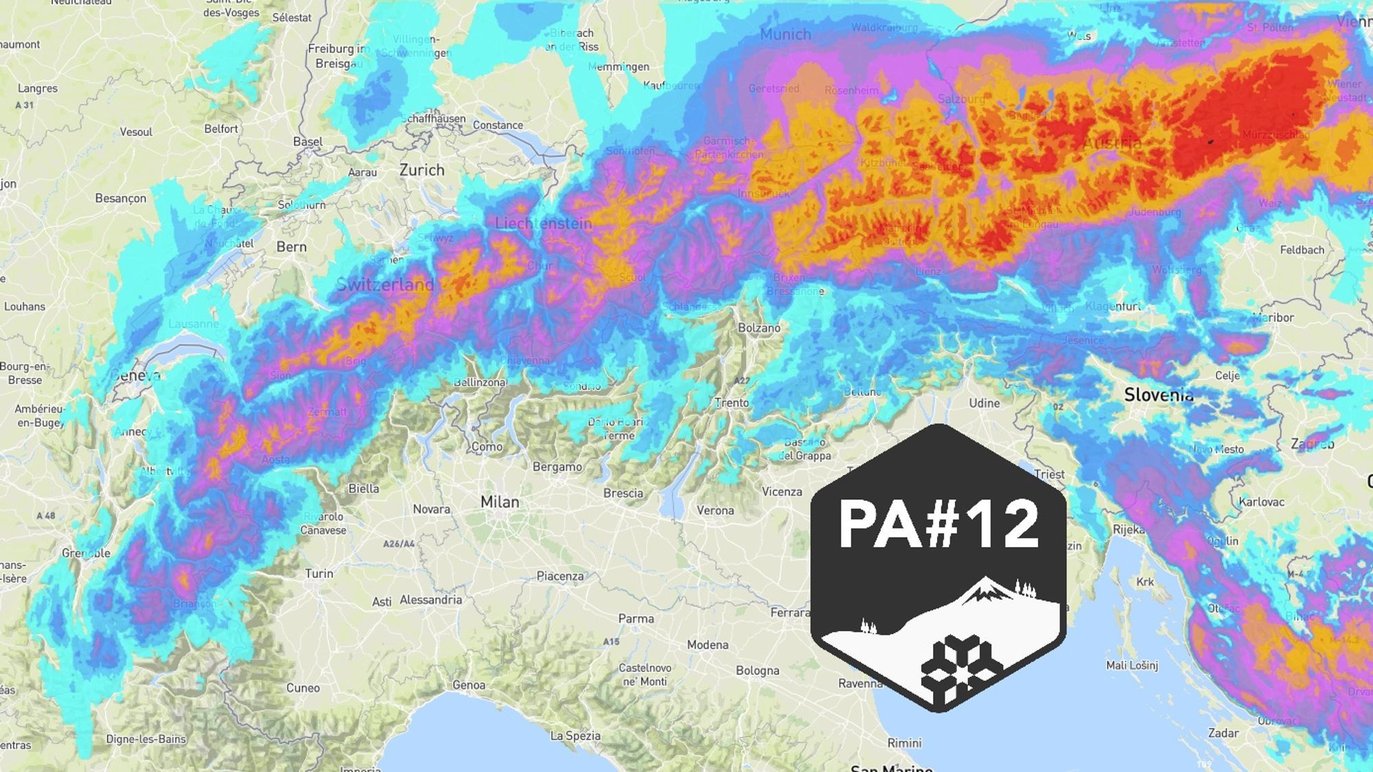
Jackpot for Austria
The frontal precipitation transitions almost seamlessly into orographic snowfall from the northwest. This second wave brings snow from the French Northern Alps all the way into large parts of Austria. On Thursday, snowfall continues at intervals across the Northern and Western Alps. On Friday, the flow becomes due north and a high-pressure system moves in from the west. Austria can still see significant snowfall at this stage, which explains the high totals expected in the eastern Northern Alps. Even on Saturday, the eastern half of Austria may still see scattered snow showers.

- 1cm
- 5cm
- 10cm
- 15cm
- 20cm
- 30cm
- 40cm
- 50cm
- 75cm
- 100+
- 1mm
- 5mm
- 10mm
- 20mm
- 30mm
- 60mm
- 120+
Follow the snowfall evolution in our animation
Drier in the south, but snow chances for the Dolomites and Carinthia
The French Southern Alps - already missing out on most frontal precipitation - are too sheltered for this NW‑stau. The rest of the Southern Alps also stays mostly dry. There is, however, one clear exception. Under the influence of the Italian low, it will likely snow in the Dolomites, Carinthia and Slovenia on Wednesday night. Totals of 10-25 cm are possible, though uncertainty remains about the exact position of the low. In the worst case, only a few centimeters will fall. In a more favorable scenario, if the southern orographic lift lasts long enought, 20-40 cm is possible.
Up to a meter possible in the east
Here is an estimate of total new snow between Wednesday and Sunday based on our model:
- French Southern Alps and Alpi Marittime: 0–10 cm
- French Northern Alps: 20–50 cm
- Switzerland (north of the main ridge): 30–60 cm
- Austria west of Innsbruck: 30–50 cm
- Austria east of Innsbruck: 40 to over 100 cm (the farther east, the more)
The weather models are fairly consistent. ECMWF and UKMO are even more generous for eastern Austria, with totals exceeding 140 mm/cm:
Wind and fresh snow: rising avalanche danger
The weak layer in the snowpack that has troubled us all season has partly stabilized but has not disappeared everywhere. In addition, strong winds last week - especially in France and Switzerland - transported snow and created new wind crusts elsewhere. Plenty of weak spots remain, and during the snowfall it will be windy again, forming new wind slabs. Expect level 3 or 4 from Thursday onward in all affected regions.
Where to go?
-
In the trees: one major advantage of the low snow line is that you can (relatively safely) ski or ride below the treeline. Areas that still have a base at lower elevations (especially north-facing slopes) will quickly become interesting.
-
Friday afternoon it becomes drier and calmer in France, while Austria still sees snowfall and strong winds.
-
Switzerland and Austria get the deepest powder, and for truly bottomless runs you’ll want to be east of Salzburg. Avoid steep slopes here through at least Sunday due to the avalanche situation.