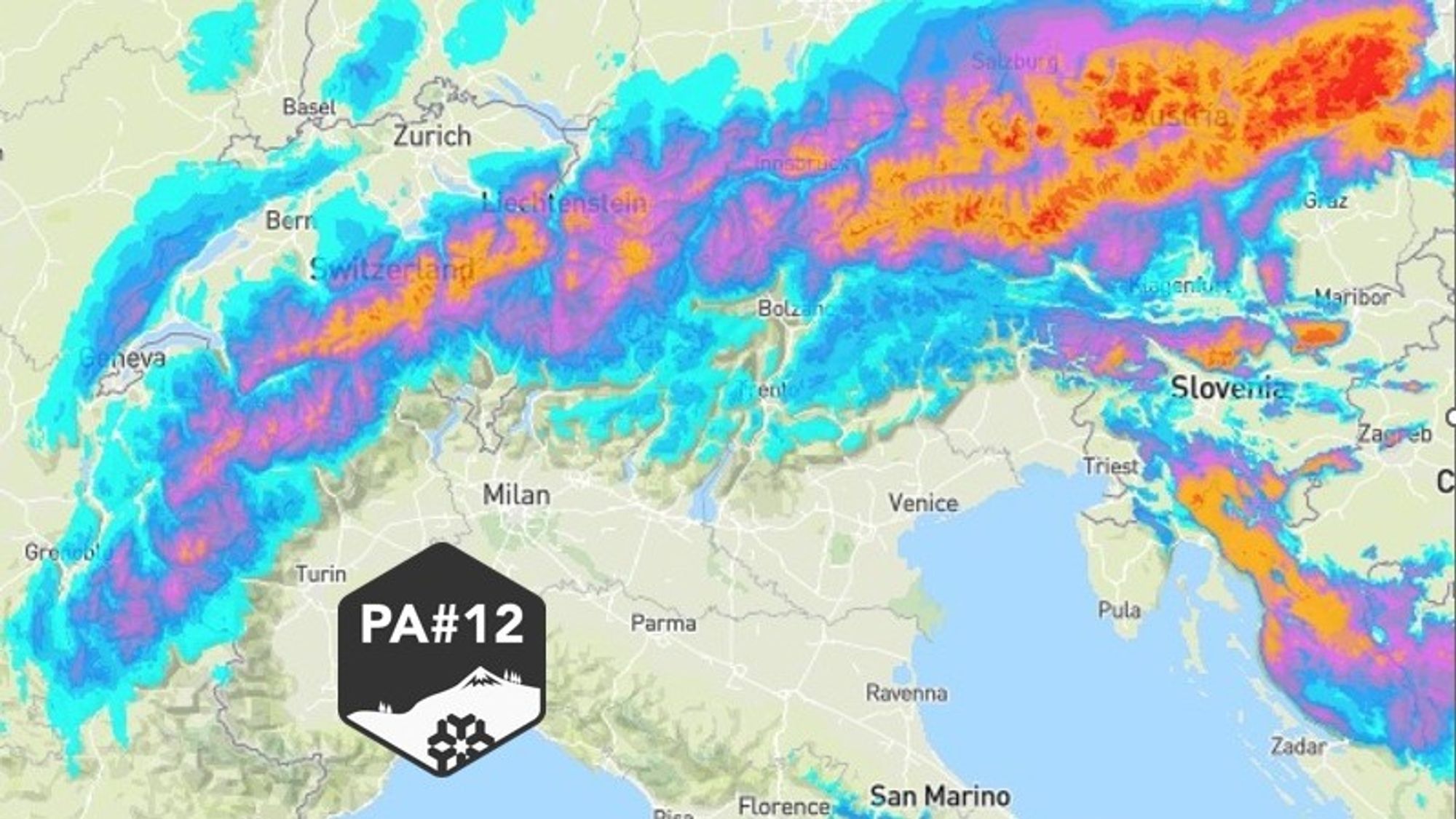
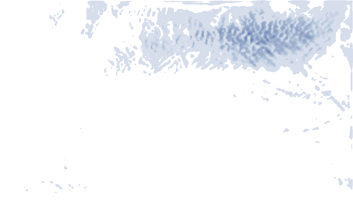
The cold front bringing winter back to the Alps is approaching fast and will reach the Alps this afternoon. It will deliver between 25 and 75 cm of fresh snow across many regions. In today’s update we take a closer look at what to expect, including snowfall totals, riding conditions for Thursday, the weekend outlook, and a first glance at next week.
How much snow by Friday afternoon
Temperatures will drop significantly over the next 24 hours as a solid shot of fresh powder arrives in the northwestern Alps. The snowfall comes in two phases, with conditions changing rapidly this afternoon. Clear skies will quickly give way to dense cloud cover, followed by widespread precipitation.
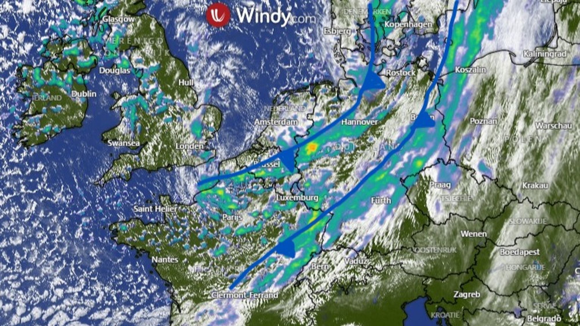
Initially, precipitation may fall as rain up to around 1400 meters, but the snow line will drop quickly to around 1000 meters before the evening. After a temporary lull in intensity during the evening, a second front moves in overnight into Thursday morning, bringing more snow and pushing the snow line down into the lowest valleys. Snowfall intensity then gradually decreases Thursday afternoon, although light snow may continue into Friday morning due to ongoing northstau conditions. In the French Alps, it will clear earlier. The strength of the upper flow means that even Carinthia and the Dolomites will pick up some snow overnight.
You can count on:
- Northern French Alps (Savoie and Haute Savoie) 25 to 45 cm (Ecrins will see up to around 20[ cm)
- Western Aosta 15-30cm
- Wallis 30 to 50 cm
- Swiss main ridge 40-80 cm
- Northern Austra and main crest 40-80cm, possibly more far east
- Dolomites 10-25cm
By Thursday morning, around half of these totals will already be on the ground — slightly more in the west, somewhat less in eastern Austria and almost all of it in the Dolomites.
Tree runs on Thursday (wind and visibility)
As already mentioned by Henri wind will play a major role over the next 48 hours. It is already increasing, with gusts around 100 km/h reported midday today, and will remain strong through Thursday. Along the main Alpine ridge and in north föhn zones, wind speeds of 80 to 110 km/h are expected, with even higher gusts possible. Conditions will only start to ease on Friday from the west.
Combined with ongoing snowfall, visibility will be poor on Thursday. If you’re heading out, stick to tree runs. Conditions improve on Friday — first in the French Alps — opening up more terrain options depending on snowpack stability.
As always: check the avalanche bulletin. Fresh snow combined with wind will create new instabilities, while deeper weak layers remain a concern, especially in areas with a thinner snowpack.
Clearings and light snow over the weekend
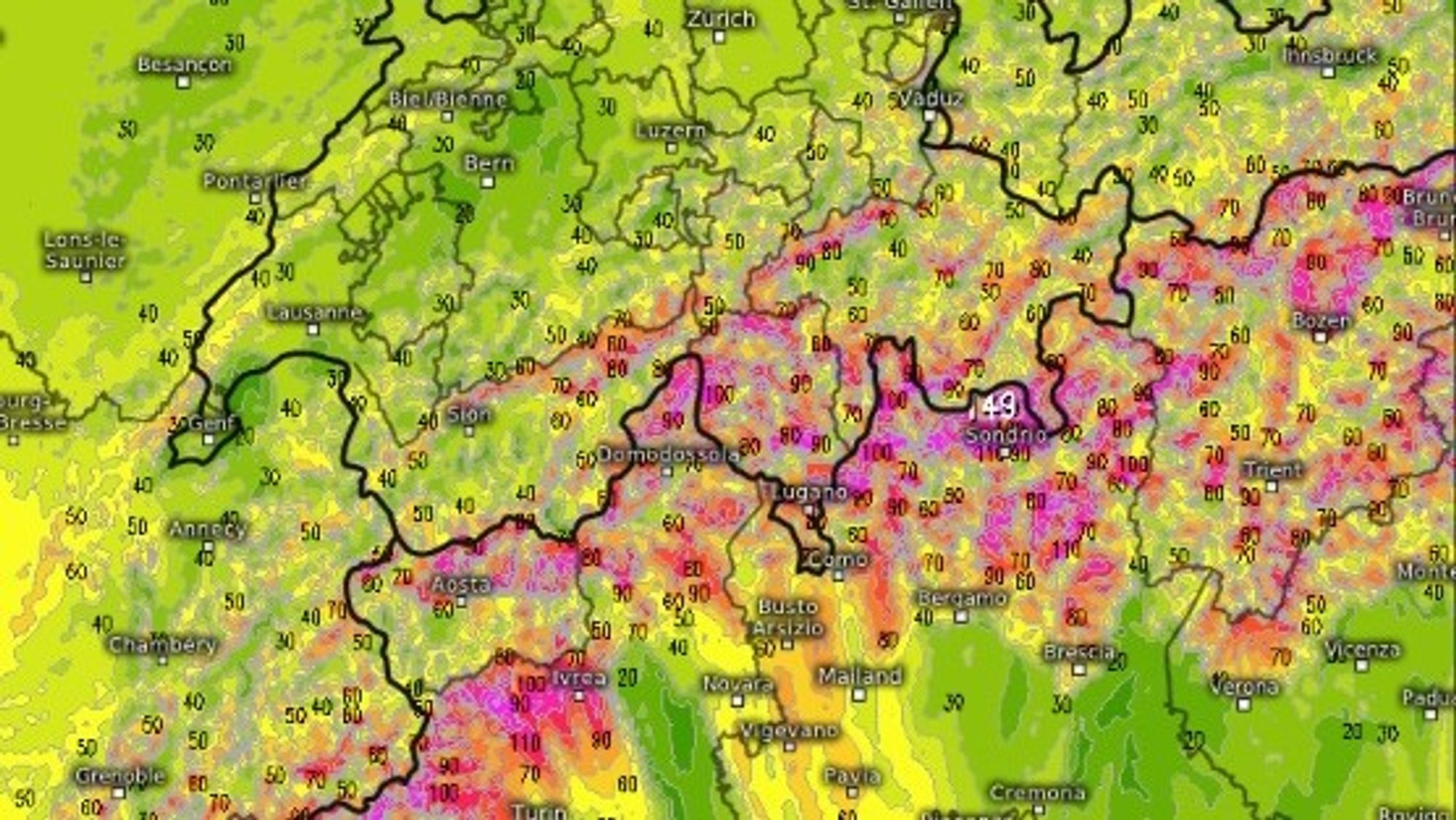
From Friday onward, skies will gradually clear from the west as precipitation tapers off. Saturday will start with better conditions, especially in Austria, while clouds begin to increase again from the west later in the day. This marks the arrival of another weak front, bringing around 10 cm of fresh snow between Sunday night and Sunday, mainly affecting Switzerland and Austria. The snow line will remain low, generally below 1000 meters.
- 1cm
- 5cm
- 10cm
- 15cm
- 20cm
- 30cm
- 40cm
- 50cm
- 75cm
- 100+
- 1mm
- 5mm
- 10mm
- 20mm
- 30mm
- 60mm
- 120+
Overall, the outlook for the weekend is solid. Cold temperatures at altitude and limited solar input will help preserve the powder. Do keep in mind that visibility may deteriorate again on Sunday, although wind will be less of a factor compared to Thursday.
More snow next week — with two caveats
After the weekend, the flow remains northwesterly to northerly, keeping snowfall potential alive. In fact, another PowderAlert is already on the horizon. However, there are two important caveats.
- In the western Alps the influence of the northerly flow may be somewhat limited due to a building high-pressure system. It remains uncertain how much snow regions like Savoie will receive. Austria clearly has the best chances.
- Warmer air will start to mix in along the eastern edge of the high-pressure system, leading to rising temperatures later in the week. This effect should remain limited in Austria but could be more noticeable further west.
All in all, Austria is shaping up very well for next week — especially considering that up to half a meter of snow will already fall there in the coming days.
Enjoy the powder — and plan smart. Stay safe out there.
Réactions
Hi, just wanted to ask… isn’t the snow map overly optimistic? Don’t see the amounts in any other forecast
@kolikjun yes it is at the moment. GFS is showing very large amounts, but it’s not backed up by EC, so the developments for early next week are still uncertain!