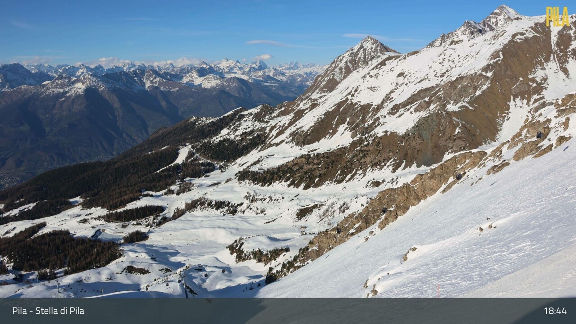
After the Easter holidays, the weather in the Alps has so far been fairly mild, with temperatures in many valleys rising above 20°C and no significant snowfall. However, things are about to change again in the coming days.

Cold front brushes the Northern Alps
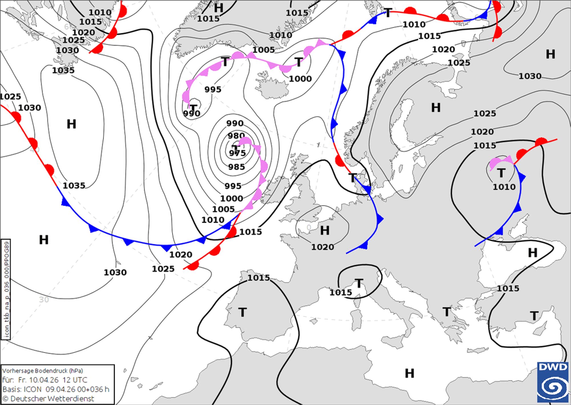
This starts tomorrow (Friday) with a weak cold front that grazes the Northern Alps. A high-pressure system quickly builds in from the west, keeping it mostly dry in the French Alps and the western half of Switzerland, aside from a few isolated showers. Further east in the Northern Alps, from eastern Switzerland into Austria, some snowfall is expected above 1500 meters (with the snow line dropping further east). Around 5 to 10 cm of snow is expected, with up to 20 cm possible in the Tauern region. By Friday evening, the system loses strength and it becomes dry again everywhere.
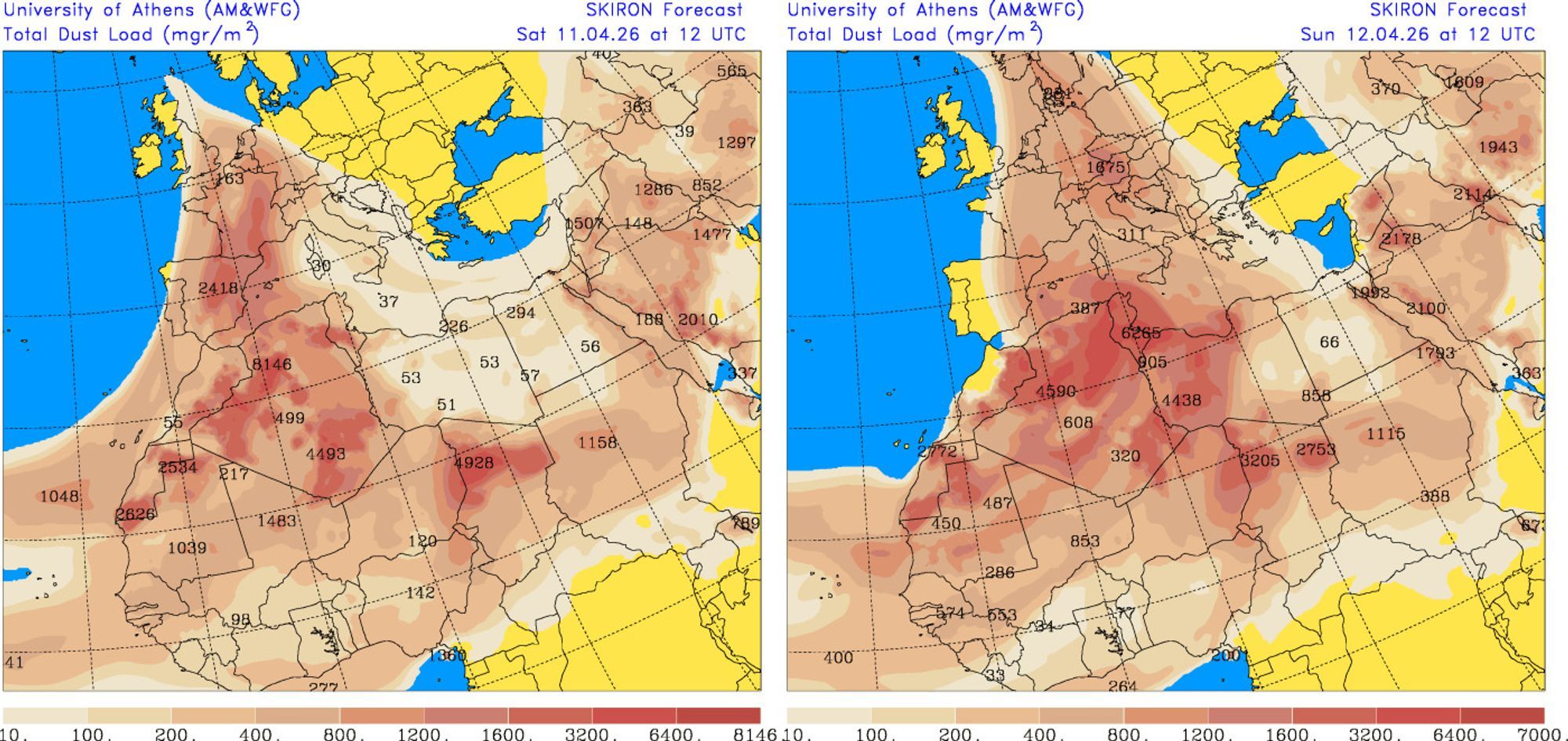
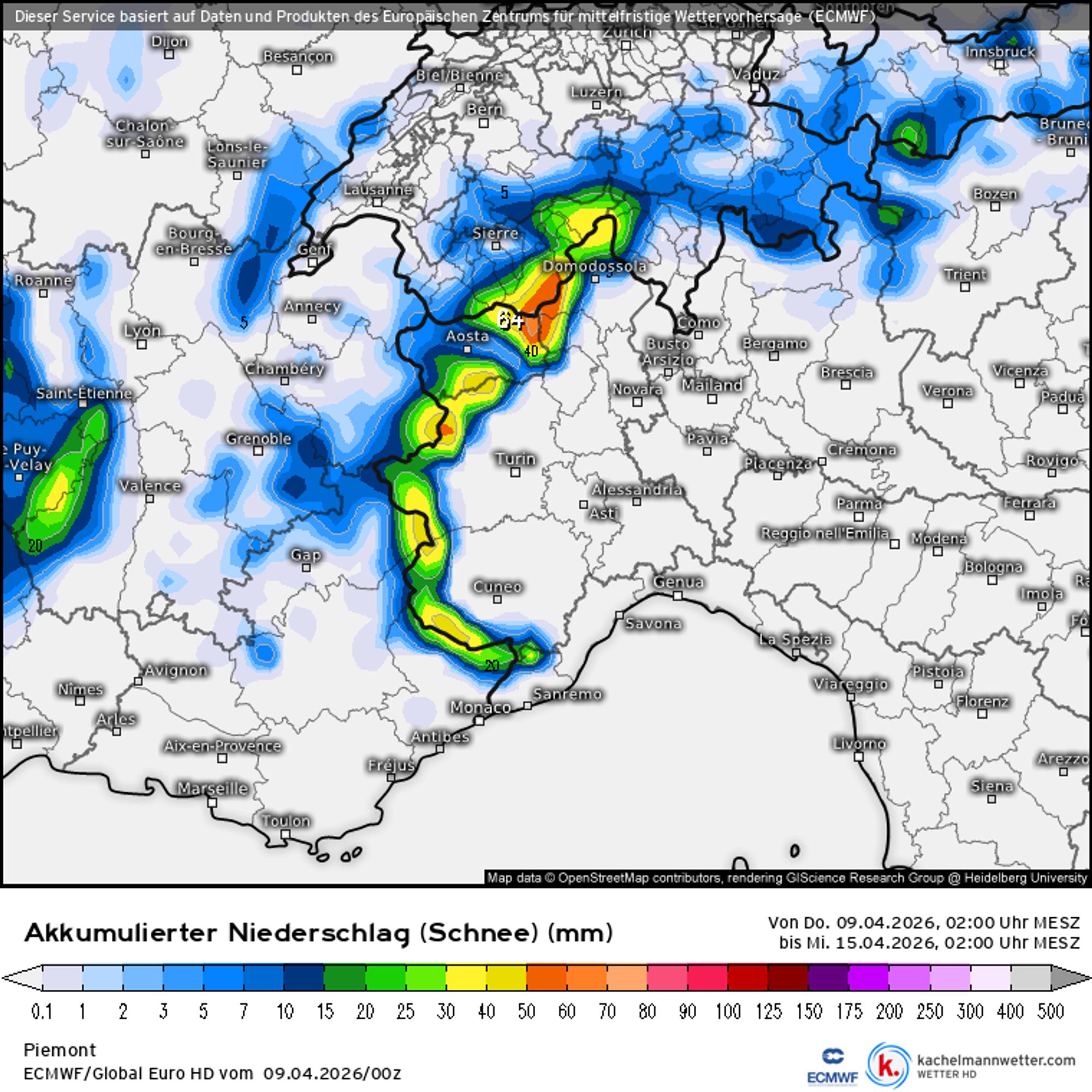
Large amounts of Saharan dust will be transported to the Alps this weekend. Forecasts for Saturday afternoon (left) and Sunday afternoon (right)
Mild conditions and Saharan dust
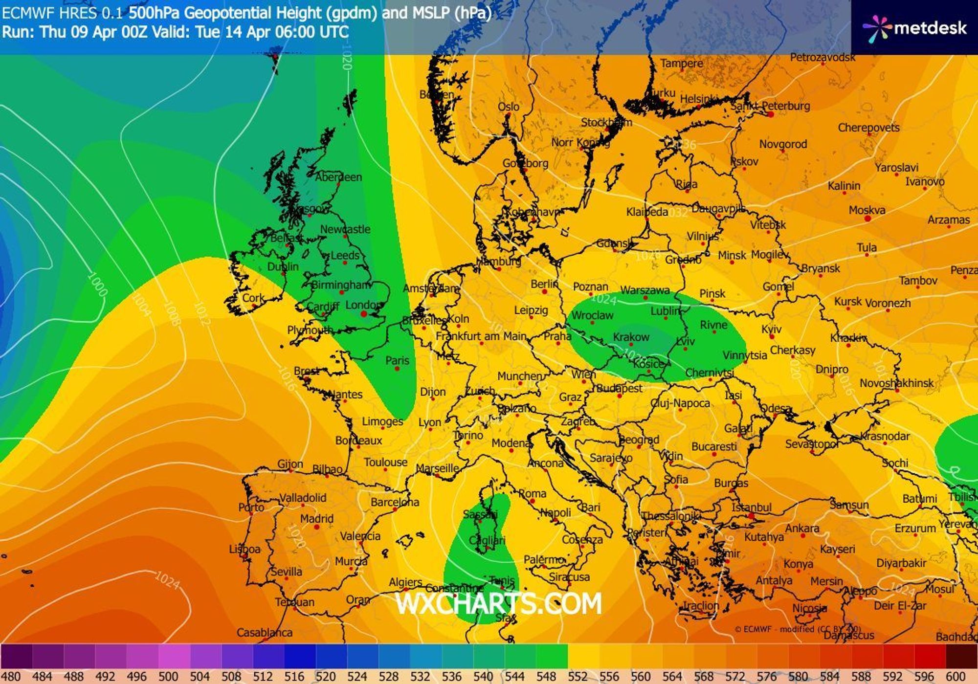
On Saturday, under the influence of a ridge of high pressure, it will turn very mild again. Temperatures will rise above freezing even at 3000 meters and exceed 20°C in many valleys, locally reaching up to 25°C. At the same time, new snowfall is approaching, driven by a large low-pressure system over the Atlantic. An influx of Saharan dust will make the air hazy and likely increase cloudiness, affecting the Western Alps first on Saturday, and the Eastern Alps on Sunday.
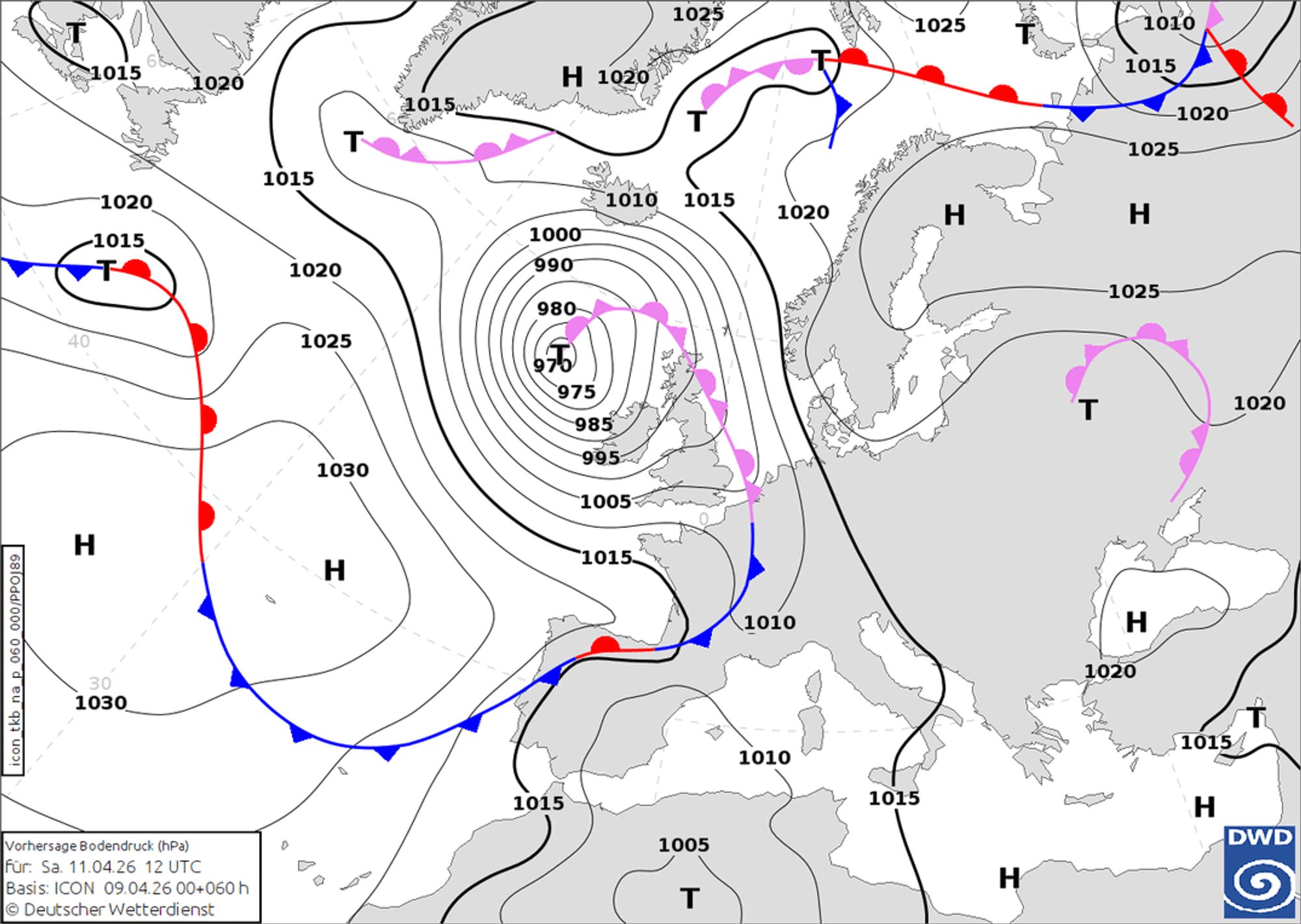
According to current forecasts, the associated front more or less stalls west of the Alps on Saturday. Meanwhile, a cold pool over the Mediterranean supplies moist air. By Saturday afternoon and evening, the first showers may reach the northwestern Alps. During the night into Sunday, the front edges closer, and snowfall is expected to begin in the Western Alps during the day. Initially, the snow falls in relatively mild air, with a snow line around 2000 meters or slightly higher. Snowfall remains limited to the western edge regions at first, while inner-alpine areas and regions further south stay drier.
At the same time, a cut-off low over the Mediterranean causes orographic lift along the Alpine arc near Piedmont, intensifying overnight into Monday. On Monday, somewhat cooler air reaches the French Alps, lowering the snow line in Savoie and Haute-Savoie to around 1500 meters and eventually slightly below. However, snowfall amounts there remain limited. On the Italian side, it also stays mild, with snow mostly falling above 2000 meters, but this is where the largest accumulations are expected. Forecast models still disagree on totals, but 20–40 cm at higher elevations in regions like Aosta looks plausible. On the French side, snowfall totals are less impressive, generally around 5 to 10 cm, with slightly higher amounts in some areas.
Outlook remains uncertain
The outlook for next week is still highly uncertain, as the Alps will be positioned between a trough to the west and two cut-off lows to the south and east. The exact movement and positioning of these systems will have a major impact on the weather.