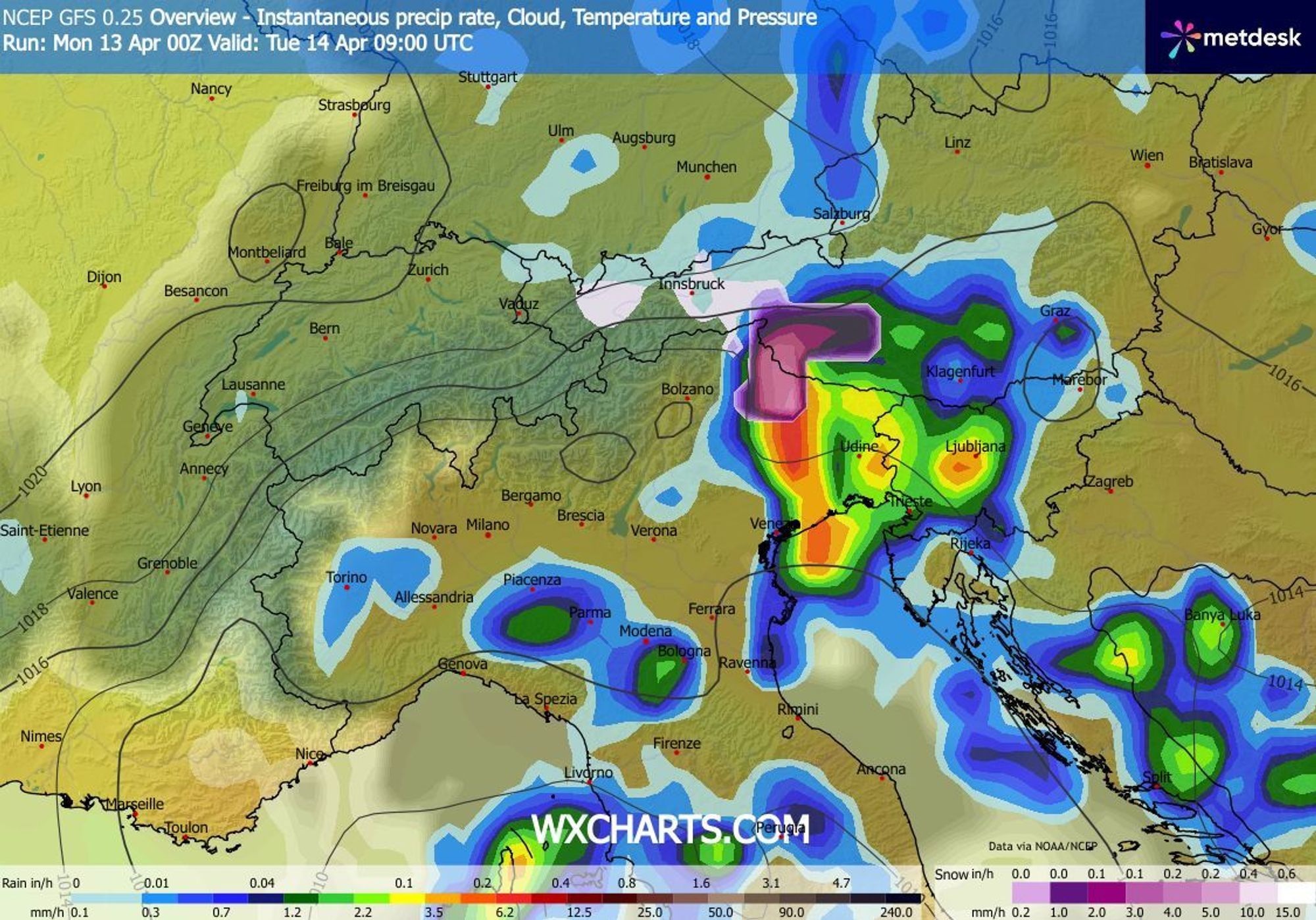
An impressive low‑pressure system moved from Algeria to central Italy over the past 24 hours and is pushing mild, moist air toward the Alps. This air mass also contains Saharan dust, which may be deposited onto the snowpack during rain and snowfall. The snow line lies (well) above 2000 metres, but during periods of intense precipitation - especially in the evening and overnight - it may temporarily drop. Scattered precipitation is affecting large parts of the Alps. We zoom in on the regions where the most snow is clearly expected today and tomorrow (Tuesday). After that, we take a look at the weather charts for the rest of the week: does the unsettled weather persist, or will spring return?

Already 10 to 30 cm this morning from around 2000 metres
This morning, Italian weather stations in Piemonte and Aosta already measured 20 to 50 mm of precipitation. Southwestern Switzerland was also wet, with snowfall at higher elevations. These are the measured amounts of fresh snow up to 08:00 this morning:
33 cm – Macugnaga Rifugio Zamboni (2,075 m)
30 cm – Alagna, Bocchetta Pass (2,371 m)
23 cm – Bortel–Bortelsee (2,517 m), CH
20 cm – Morgex–Lavancher (2,842 m), IT
19 cm – Simplon–Wenghorn (2,424 m), CH
19 cm – Rifugio Vaccarone (2,735 m), IT
17 cm – Champorcher, Rifugio Dondena (2,181 m), IT
13 cm – Diga del Chiotas (1,994 m), IT
11 cm – Grange Martina (1,975 m), IT
Hazy grey skies and precipitation mainly on the southern side
Anyone currently in the Alps has probably already noticed it: since yesterday, concentrations of Saharan dust have been high. In addition to widespread cloud cover, this results in a noticeably hazy atmosphere, sometimes with yellow to brown hues. Over the coming 24 hours, the dust plume will slowly shift eastward. Until then, especially overnight and in the morning, precipitation may still cause dust deposition - the notorious brown layer on the snowpack. Easterly winds at high altitude will occasionally produce gusts to 50-70 km/h.
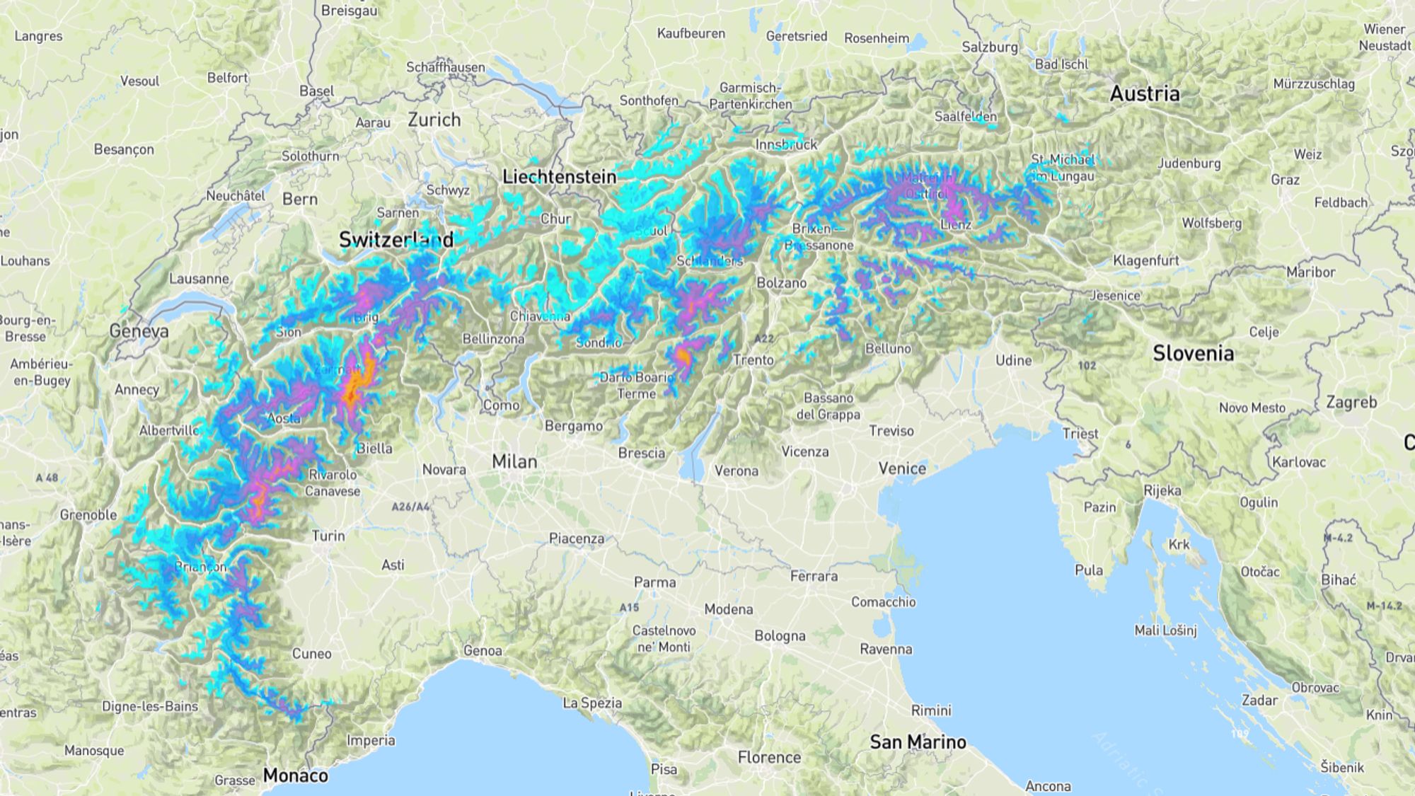
Locally over half a metre of fresh snow
The precipitation started as Südstau and gradually transformed today into a retour d’est. This evening, moisture is still being advected from the east, and especially in Piemonte, Aosta and Valais, another 10 to 20 cm of snow may fall. The snow line may regionally drop to around 1.800 metres. Combined with what has already fallen today, I expect several measuring stations in these regions to exceed 50 cm of fresh snow. This applies in particular to higher elevations of Zermatt–Cervinia, Saas‑Fee and Monterosa. Lifts in these last‑mentioned areas are still operating until 19 April.
In the northern part of the Italian inner arc, south of Aosta, the fresh snow cover may also build up to half a metre. However, you’ll need to make the ascent under your own power, as no lifts are running. Part of the precipitation may cross the main Alpine ridge into France, leaving 10 to 20 cm in areas such as Bonneval‑sur‑Arc, Val Cenis and Tignes.
Shift toward the east, rising snow line tomorrow
While conditions become drier overnight in the western half of the Alps, the east will instead see showery precipitation increase. This activity is quite erratic, making it difficult to pinpoint exactly where the focus will be. Roughly east of the Bormio-Sölden line, 10 to 20 cm of snow may fall above 2200 metres. This applies to the Dolomites, but also to Carinthia and southern Tyrol. Especially in Carinthia, for example in the Lienz Dolomites and the Carnic Alps, totals could locally reach around 30 cm. The initial precipitation may fall as snow down to about 1700 metres. During the day on Tuesday, however, the snow line will rise to 2100-2400 metres, which unfortunately is too high for most areas in these regions.
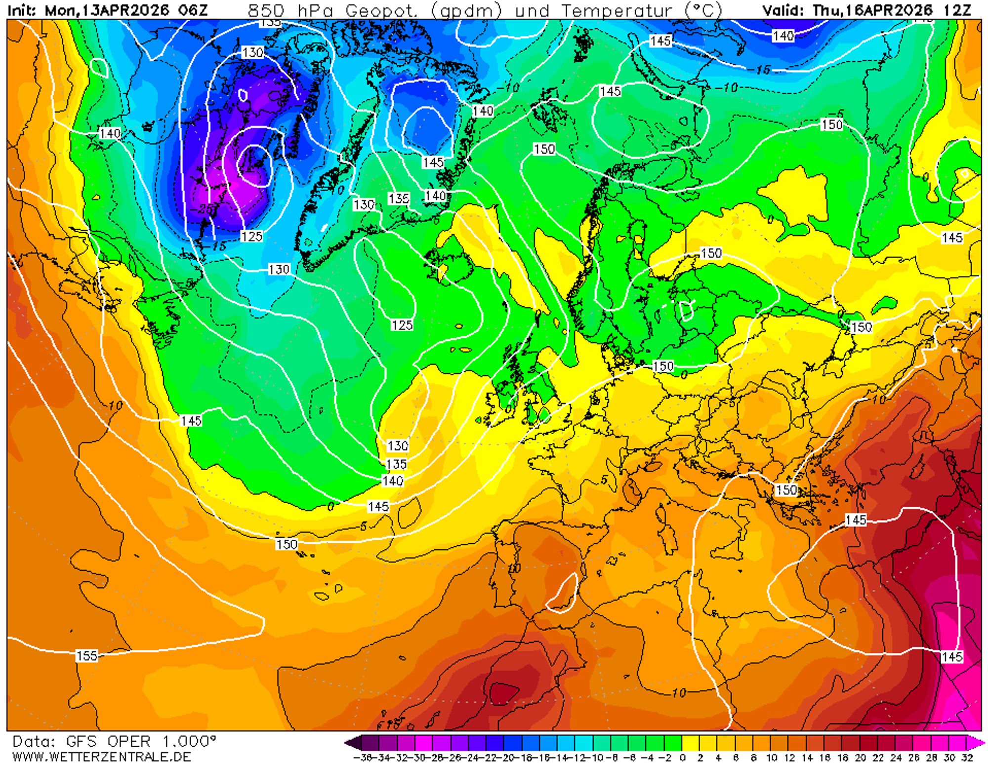
Rising pressure, gradually more sunshine
After the precipitation on Tuesday in the eastern Alps, conditions look largely dry across the entire range for the rest of the week. It will not turn sunny all at once, as the Italian disturbance only slowly weakens. In terms of sunshine, the French Alps are likely to benefit first, followed by more frequent clear spells elsewhere in the Alps on Thursday and Friday. On Tuesday, the freezing level will range from 1800 to 2400 metres (from northwest to southeast), but on Wednesday and Thursday somewhat milder air will arrive from the southwest. The freezing level will likely rise again to close to 3000 metres. Over the weekend it will probably remain very mild, with an increasing chance of a few spring showers with a very high snow line.