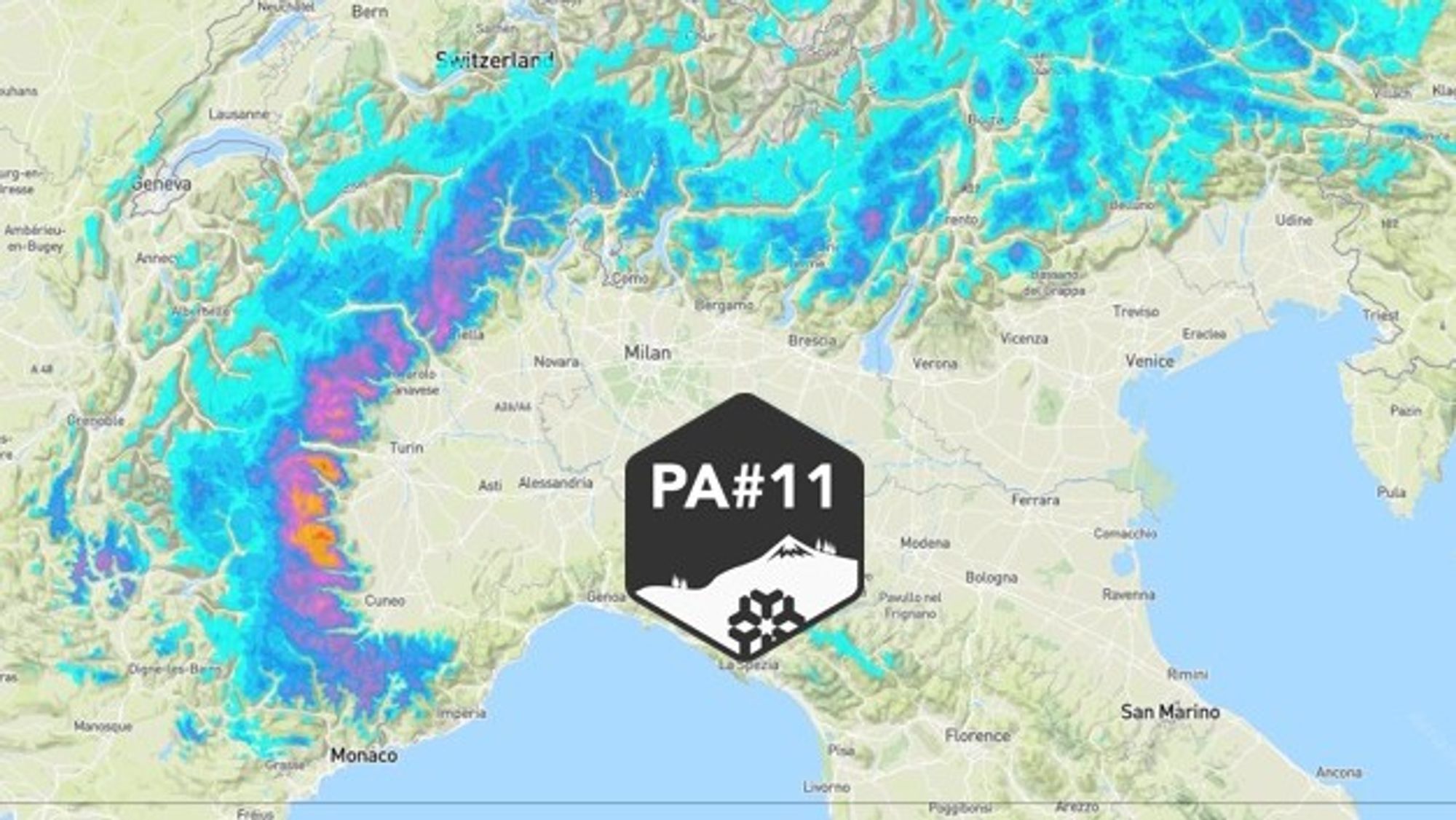
Henri already mentioned on Wednesday the pool of cold air that would drop toward the Alps. This upper-level cold pool will generate a short-lived easterly stau setup along the Italian inner arc. A pleasant surprise — and enough for us to issue PA#11 today! It’s a mini alert for a fairly small region with 20-40cm expected above 1000m… The weather charts still look quite wintry, and there are already signs of a much bigger PowderAlert toward the end of next week.
In this forecast we will address:
- Lead-up to PA#11: weather today and tomorrow
- Expected snowfall: powder on Sunday for a limited area
- A major dump on the horizon next week

Lead-up to PA#11: weather today and tomorrow
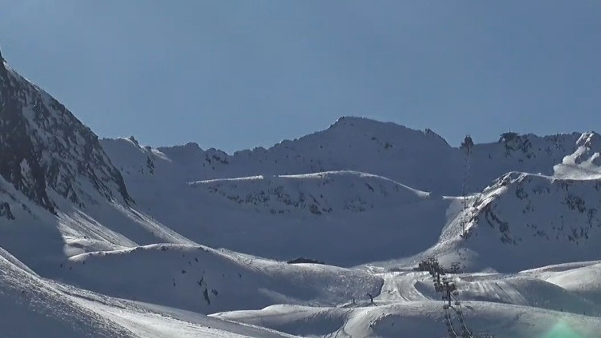
Today skies are mostly clear with typical early spring conditions (cold start, sun influence later in the day and temperatures around or just below freezing at 2000 meters.
Tomorrow conditions will be less bright, especially in the Eastern half of the Alps. A disturbance in the upper atmosphere — currently near the Baltic States — is moving southward toward southern France. This will gradually increase instability tomorrow with colder air aloft. Expect more clouds (especially in Austria) and some snow showers developing. Snow line will be around 1200m and 5-10cm could fall locally. In the Western Alps there will be more clearings but convective clouds will also develop there with a local shower.
Expected snowfall: powder on Sunday for a limited area
Looking at the upper-air charts, it’s clear something interesting is developing. A rotating wind field indicates the presence of a cut-off low at altitude. As this feature approaches the Alps, a small surface low is expected to develop over southwestern France.
The air mass involved is initially quite dry, so most of the Alps will see little to no precipitation. However, due to the orographic lift associated with the developing low, parts of Aosta and Piemonte will benefit from snowfall on Sunday. A few flakes may already fall on Saturday afternoon, but the main event is expected during the night into Sunday and Sunday morning, with snowfall reaching down to around or even below 1000 meters.
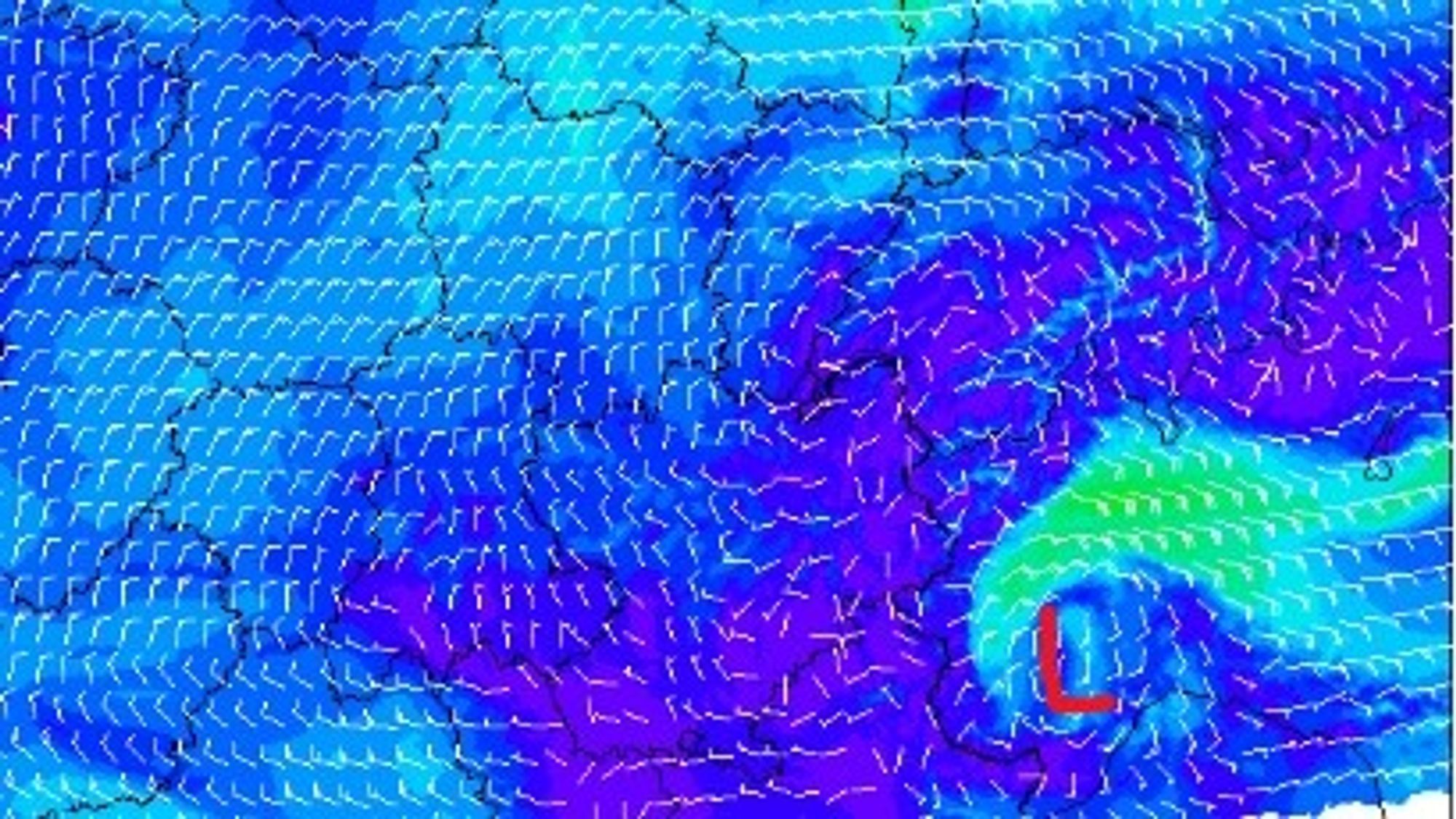
Because this is a small-scale system, details remain somewhat uncertain. Based on the expected wind direction around 1500 meters (see above) — mainly from the east to southeast — the most favorable zones appear to be the eastern parts of northern Piemonte and the Monte Rosa region. Expect roughly 20 to 40 cm of fresh snow, with some local higher amounts possible. Areas such as Prali, Pragelato, Champorcher and Alagna/Gressoney currently look like the best bets.
These regions already received significant snowfall during PA#10. That came with some downsides, such as lift closures, but conditions this time won’t be as extreme. The base remains solid above 1500 meters, generally still over 50 cm. Further south and west into the mountains, snowfall amounts will be lower. With such a localized setup, flexibility is key — and checking webcams on Sunday morning will be essential. Winds will increase from the east. Not as extreme as earlier this week — when gusts exceeded 100 km/h in parts of Switzerland and the French Alps — but still strong enough for significant snow transport, with speeds exceeding 50 km/h.
Wind slabs are currently the main avalanche risk across the Alps as the mentioned wind of the last days has created unstable conditions.
An interesting read for Austrian conditions here with similr challenges elsewhere in Switzerland and Italy.
A major dump on the horizon next week
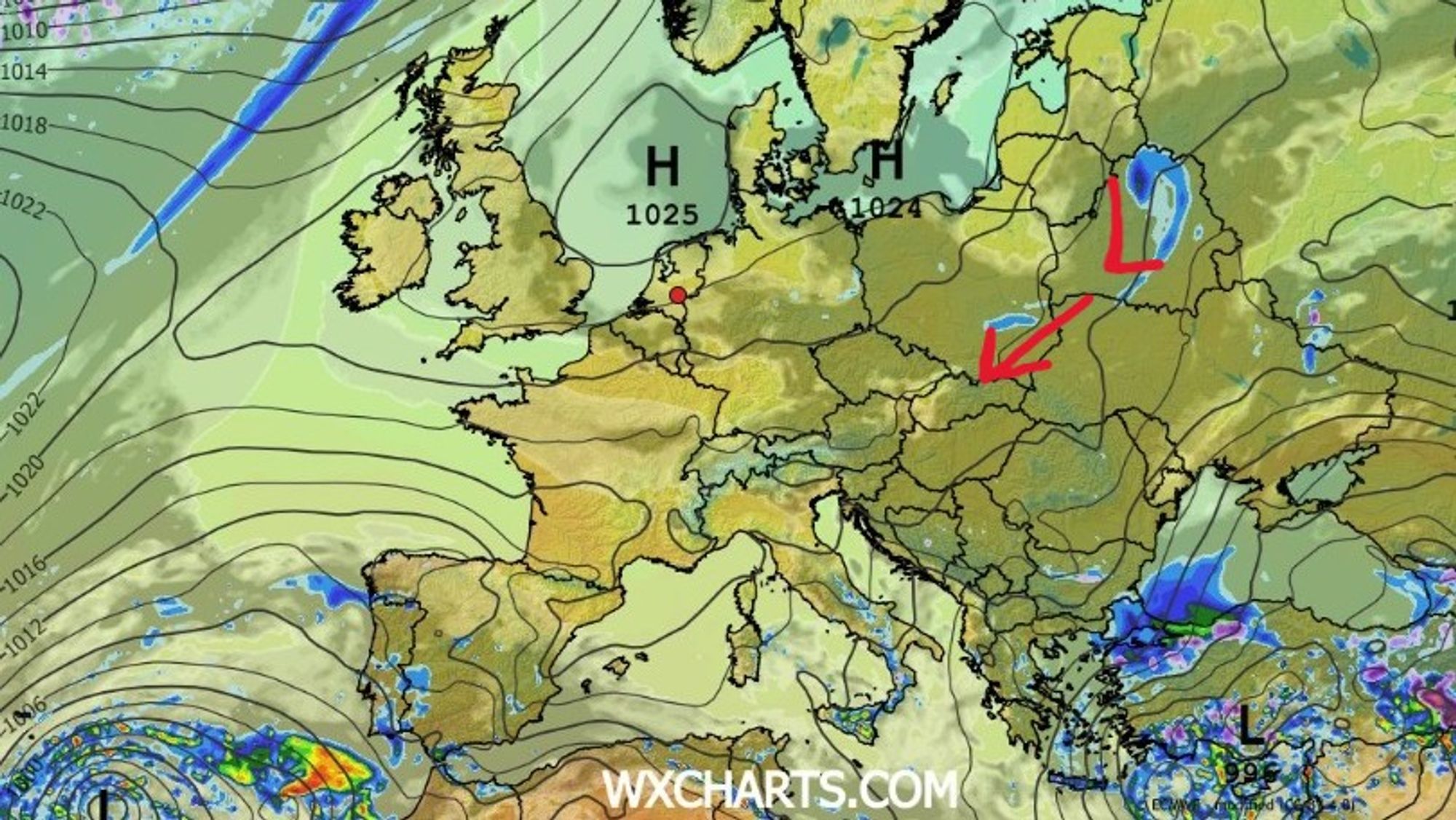
High pressure will briefly regain control from the Azores, bringing a couple of sunny days after the weekend. Temperatures will rise slightly toward Tuesday, but it won’t turn truly warm. After that, a major shift is on the horizon — and it looks like a proper late-winter comeback. The high retreats back to the west, allowing a cold front to push into the Alps from the northwest around Wednesday or Thursday. This is followed by the development of a separate low-pressure system over the eastern Mediterranean or the Balkans, which may linger there for several days.
This setup opens the door for a sustained northerly flow, bringing cold air and snowfall to the Alps. While model details still vary — especially regarding snowfall on the southern side — the northern Alps look set for a genuinely wintry period. A classic north stau setup with cold air and potentially more than 50 cm of fresh snow appears increasingly likely from Thursday onward, especially in Switzerland and Austria, with Austria currently closest to the core of the system and therefore higher totals. Definitely something to consider planning for!
Reacties
Based in Chamonix and considering chasing PA #11 tomorrow through the MB Tunnel and into Aosta. Where do you recommend closest drive that will get considerable snowfall from this localized storm? Champuluc?
Here now in Saint Vincent (Aosta Valley)…just left the first flurries falling in Cervinia and you could really feel the cold air mass arriving, brrrrr, feels like winter day.
Yesterday the conditions in Monterosa were terrific, with the top up tonight, gonna be epic!
What days should be the best days to head out in Verbier based on current forecast? Friday-Saturday?